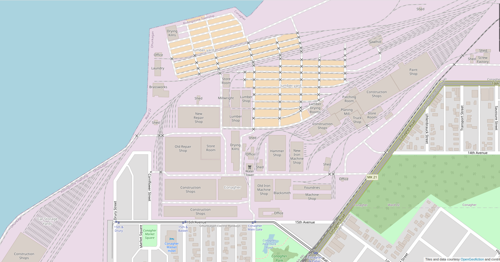
I was inspired by a recent bit of “OOC documentation” by the OGF user donnamaw (here) to discuss, if only in outline form, the real-life origin stories of my various geofictions. How and when did I invent, in my imagination, the various places that I have drawn (or attempted to draw) maps of?
The order in which these places were drawn or introduced to geofictional spaces is not the order in which my mind created them. Here I’ll try to present them in the order in which they were first imagined.
Rahet.
Rahet is a planet. It has four main continents, which bear a reliable suffix meaning “continent,” -eye (pronounced as IPA /eje/). The history of Rahet is one of human colonists settling a desert planet and terraforming it over 1000’s of years. The terraforming process is frequently interrupted by squabbles among the factions that emerge, but nothing is stable, and few nations and groupings last more than a few generations. The technological level is high but unequally distributed – you have spaceships and artificial intelligent machines coexisting with spears and chariots. There is a particular faction, led by a machine named “Zon,” which keeps the terraforming project more-or-less “on track,” but often at the cost of moral clarity.
All of this was developed in my imagination beginning around the age of 10. I was a bit precocious as a child, and by 10 I had read the Lord of the Rings, the Dune books by Frank Herbert, and numerous other pulp sci-fi works by authors such as Andre Norton, Alan Dean Foster, and Harry Harrison, among others. These types of works influenced my thinking about Rahet, and by age 12 or so I had a quite clear picture of the planet’s historical trajectory and some of the key elements of the culture.
I began drawing maps early. Most were focused on the continent called Tsiqeye, which is where the earliest settlements were established, around a rock formation called Redithk Illim (which resembled in my imagination Wyoming’s Devil’s Tower, but much larger). I remember drawing out an outline of the continent with coastlines and major rivers at around age 11, taking it down to the photocopy store (such as life before scanners and cheap, high quality printers), and making a hundred “blanks.” I numbered them at 50 year intervals (thus covering 5000 years of history), and then drawing a series of historical maps for the nation-states, tribes, empires and other factions playing out Rahet’s complicated and intricate history. I wish I still had those maps.
A few years ago I uploaded Rahet to my new geofictician server, but later deleted it, deciding I wasn’t ready to dedicate an entire server to the project. Here is a (sadly blurry) screenshot from that time when it was uploaded.
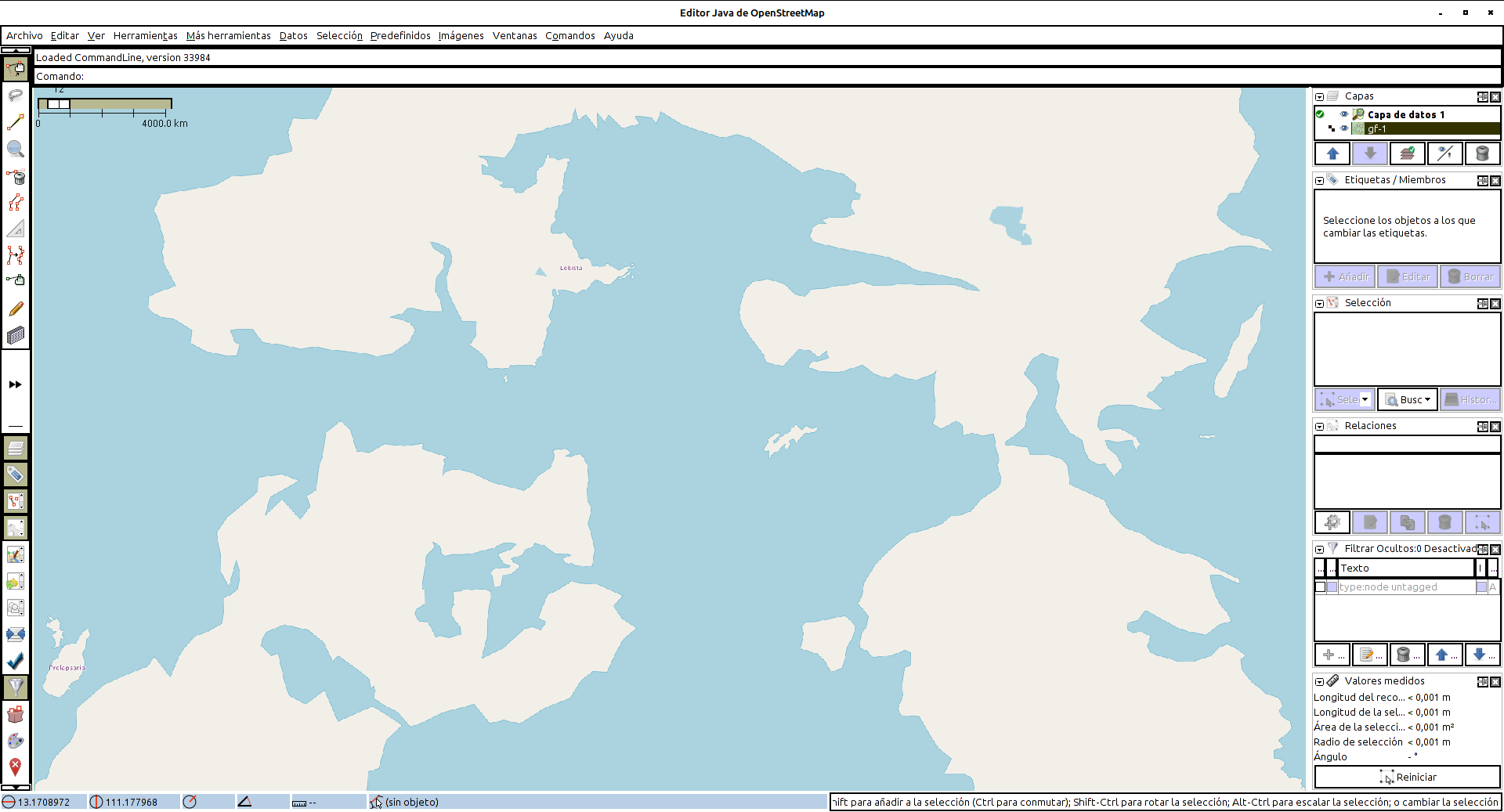
Rahet has remained a constant in my imagination ever since my pre-adolescent years. Note that the name is an anagram of “Earth.”
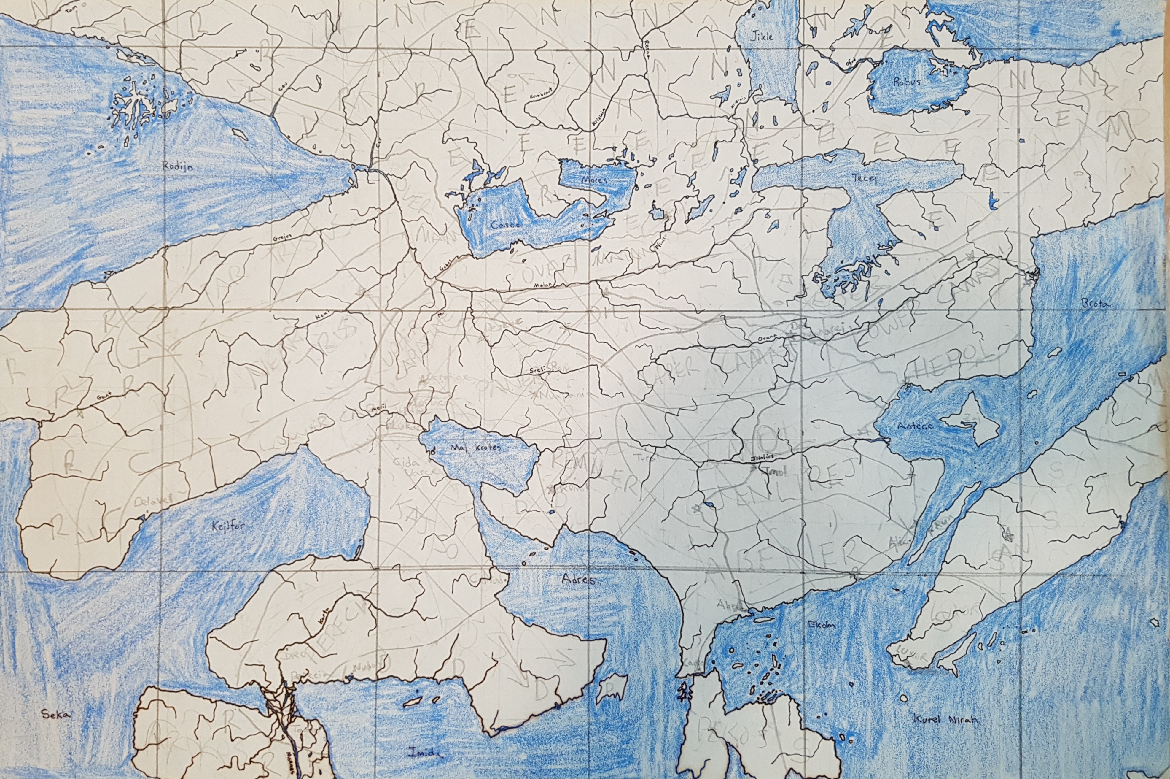
Here is a map I found just recently, of the Rahet continent called Preye. I believe I was in high school when I drew this (early 1980s).
Ta Hre.
Ta Hre is another planet that was created around the same time as Rahet. It exists in the same universe, but rather than being an earth-like, terraformed planet it’s an airless moon, with people living in pressurized “cities” laid down in craters and canyons in the moon’s surface. I never really attempted to draw maps of the planet as whole, but I did draw many of these enclosed cities – often not just standard airplane-view maps, but also elevation diagrams of the various levels of the cities, since they were fully three-dimensional. Ta Hre is another anagram of “Earth,” of course.
Mahhal.
Mahhal is a few years younger than Rahet. I created it in high school. In fact, it started as two separate planets/cultures that I merged into one when I was in college.
The first, which gave the name of the planet, Mahhal, was created as a kind of “antagonist” to Rahet. I had started trying to write a novel about Rahet, and I needed some “bad guys” so the novel would have a strong life-or-death conflict. I created the Mahhalians as an alien group who arrived at Rahet at some point and attempted to conquer it. They mostly failed, but they maintain outposts and fight occasional skirmishes with the Zon faction which works to protect Rahet’s independence.
Over time, I created the Mahhalians’ background, including a conlang and ideas about their culture and planet. They are a kind of dystopian theocracy, but very high tech. They are humanoid (and in my never-completed novel, I leave as a kind of open mystery whether the Mahhalians are mutant humans or an unrelated species). They live on a world that is currently in an “ice age,” thus there are permanent ice caps on both poles and extending to about 40° latitude. Only the equatorial zones are habitable, but the Mahhalians have built vast, high-density cities, often protected by strings of giant domes across the landscape.
The other geofiction, created at the same time, I called Pas Daons. It wasn’t a whole planet, but a country. In particular, I created the cities called Derindonderak and Askendom. In its first iteration, Pas Daons wasn’t a high tech or alien society. It was just a kind of alternate Earth, such as would fit in well on OGF today. I drew a detailed “city atlas” on paper of the city Derindonderak, and I still have clear visuals of the city’s layout, its topography, street plan, etc.
However, by my second year in college, I’d “borrowed” Pas Daons to give more detail to my Mahhalians, and thus Derindonderak became the commericial capital of Mahhal, and I came to see Pas Daons as a “historical snapshot” of the more advanced Mahhalians.
Rahet/Mahhal and the novel that was set there were abandoned when I moved to Mexico, and lay dormant until I attempted to resurrect Mahhal as an OGF archipelago in 2015. I had to make a lot of compromises with respect to my original vision for the Mahhalians – they had to be demoted from high tech, planet-controlling aliens to mediocre humans confined to a high-latitude archipelago. They retained their dystopian theocracy and conlang, however.
At this point, I consider my effort to port Mahhal into OGF to be an abject failure. I became dissatisfied with the compromises I felt I’d been forced to make, and my hope to recreate the seething metropolis of Derindonderak (so vivid in my imagination) was disappointing. I retain a “rump state” version of Mahhal in OGF mostly to justify the existence of Tárrases (q.v. below) – and because I just like the name. It’s my oldest and most closely cherished imaginary name.
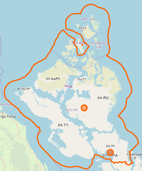
Here is Mahhal as currently drawn on OGF (and link to boundary relation):
Rasf-sayan.
Rasf-sayan is another geofiction I developed in high school. In its first incarnation, it was a parallel-earth Caribbean island with a conlang meant to resemble a native American language. I modeled it socially and culturally on Haiti. I didn’t start a novel about Rasf-sayan, rather, I started an epic poem about a character named Aochra. He is fighting corruption and trying to save hopeless lives mired in poverty. He’s kind of a cross between “Blade” and Bob Marley. I drew lots of detailed paper maps of Rasf-sayan in high school, mostly focused on the main city, Poer-rasf-oa.
At some point in college, I hijacked Rasf-sayan for my Rahet project. The hijacking was thorough and I don’t regret it. Rasf-sayan became an island on Rahet, in the sea between the continents of Preye and Sekieye. Rasf-sayan is mired in poverty because it is one of the pockets of Rahet controlled by the ruthless and inhumane Mahhalians. They have one of their space elevators anchored on the island, that allows them easy access to and from the planet. In the Rahet novel, the main character is trying to reach Rasf-sayan, because he needs to get off-planet. That’s his McGuffin that drives the plot. He meets Aochra, as a supporting character, and who is double agent – nominally working for the Mahhalians, but secretly allied with the Zon.
Ultimately, any geofiction I draw of Rasf-sayan will be located and integrated to Rahet. Here is Rasf-sayan on Arhet, as of right now.
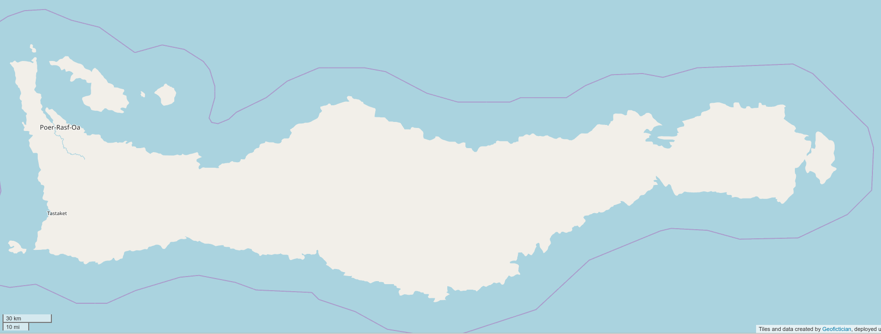
It’s barely started. But I retained it when I deleted the rest of Rahet and made it into Arhet (see what I did there?), because I thought I’d work on it at some point.
Ardisphere.
Ardisphere had a strange genesis. There is a novel by Vladimir Nabokov, entitled Ada. I believe there is a bit of geofiction (or at the least, alt-history) in that novel, since the Russians seem to control North America. An important setting in that novel is a place called Ardis Hall. I must acknowledge that that is the origin of the name Ardisphere. But… the imaginary country came after the name, by a few years.
At first, I remember using the name Ardisphere for an early website I developed, as a kind of alternate identity where I would present my geofiction ideas or half-made novels. I made my first website in late 1994 (the web was only 2 years old at that time), on a thing called geocities – an early free website hosting service. I had a “professional” site that I used for my work at that time, and personal site, that was called Ardisphere.
It was only a few years later, after I allowed the Ardisphere website to pass into internet history, that I started using the same name for an imaginary country.
I had started a novel in which a group of refugees from earth, traveling in a sub-light-speed “generation ship,” arrive in another star-system with an earth-like planet, inhabited by a alien race that has a technological level similar to humanity’s. As refugees, the aliens decide to grant to the humans a few thousand square kilometers of mostly desert land they aren’t much using, to build their own refugee country.
I drew a detailed map of Ardisphere. Since many of the refugees were from Latin America, most of the cities ended up with Spanish names. Hence Villa Constitución, Cerro y Casa, Puerto Desolado, El Cabo, Palmeras Grises. The names were such as I imagined a modern group of Spanish-speakers might apply to the alien planet they were colonizing while focusing on the ideals of their “new earth.”
The novel was about a point in time about 100 years after the building of the settlement, at a point when aliens and humans have started to coexist in a hybrid culture. The novel, like all my novels, never reached any kind of finished state, but it included “Clarkean” magic (i.e. “any sufficiently high technology is indistinguishable from magic), criminal gangs from poor neighborhoods (the slums of VC), aliens engaging in conspiracies to control the humans they’ve welcomed to their planet, and humans doing the same in return, etc. The novel also has the seed of what later became the Cartographers and Cyclopedians – freemason-like secret societies that play a large role in the evolution of life in the country.
Interestingly, in the original map of the Ardisphere, it was a peninsula. When I first stumbled across OGF in early 2014 and made an account, I took the only green country I saw at that time, AR025. That wasn’t a peninsula. But I’d already decided to make Ardisphere my first OGF creation. That was partly because I felt that, among all my sci-fi geofictions, it would be the easiest to adapt to the OGF “real world” style setting. I had to rearrange the geography completely to fit the peninsular Ardisphere of the novel into the oddly shaped, mostly land-locked territory in western Archanta. But I consider the adaptation to be successful: I cannot visualize Ardisphere at all in my mind now, without calling to mind what’s become the iconic shape of AR025.
Since aliens weren’t allowed on OGF, and since I was living in Korea at the time, I made a spur-of-the-moment decision that my Ardispherian aliens would be Koreans. I don’t regret my decision. The Latin/Korean hybrid that OGF Ardisphere became is intriguing and has a lot of interesting cultural details.
I am currently undecided as to the fate of the OGF version of the Ardisphere.
One part of me still eagerly wants to complete (or more accurately, restart) the novel set there, with changes to “fit” the OGF setting. I see it as a kind of thriller/detective novel set mostly in VC, with travels to other OGF places – Jeongto, Tárrases, Ohunkagan, Gobras City…
Further, It was only after embedding Ardisphere in OGF that I began imagining my characters might become aware they were in a geofiction, and begin manipulating it. This has given a great deal of new interest and impetus to whatever plot I finally come up with.
Another part of me wants to restore the aliens and the high tech magic and re-draw Ardisphere on its own server, unconstrained by OGF’s strictures about verisimilitude. I also feel like removing Ardisphere from OGF because I’ve been so inactive with mapping there, and I feel it is not fair for me to occupy territory on OGF that I’m not actively working on.
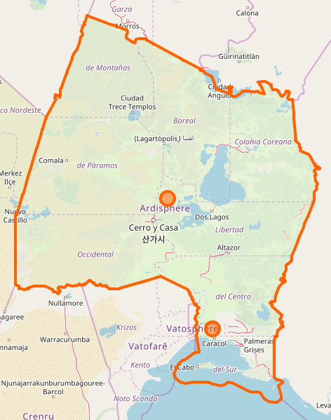
Here is Ardisphere as currently drawn on OGF (and link to boundary relation):
Lekista.
I started a novel in around 2002 which was set in a steampunk universe, but in which the main character was modeled on Augusto Pinochet, of all people. I had been reading Pinochet’s autobiography, and I had had this thought: “That is a seriously sociopathic dude. There needs to be a fictional version of him.”
So the story was, roughly, parallel to Pinochet’s life, and written from his perspective, but through the book you realize that the protagonist is a brutal dictator and he’s not a reliable narrator. It’s one of those “psychopath as protagonist” books.
I wanted to create a parallel Chile, as a place where the novel takes place, but I wanted to change the details enough that it wasn’t recognizable as Chile. So I made it a steampunk setting, and I created a somewhat alien culture. Instead of creating a conlang or using Spanish, as in Chile, I made what still feels like an inspired decision to “hint” at a conlang, but not bother with actually creating it. Thus all the place names in Lekista are “translated” into English. You have the country’s capital, Holy Brighthorse. Other cities such as Castlepass, Feast Mountain, Dogschild, etc. The names lend a bit of a native American feel to the story and setting, since a similar thing occurred with a lot of native names, especially on the Great Plains: Sitting Bull, Red Lake, Crazy Horse, Moosejaw, etc.
Eventually I gave up on the novel. I found fake-Pinochet’s mind too uncomfortable to inhabit. But I was quite pleased with Lekista, and drew many paper maps of the country and its cities.
In 2013 I drew a map, just a sketch, where Lekista was integrated to Rahet. So as of the present moment, Lekista is just one of the many hundreds or even thousands of polities that exist on Rahet. I think one of the things I like about Rahet is that its diversity allows it to “host” so many of my formerly independent geofictions.
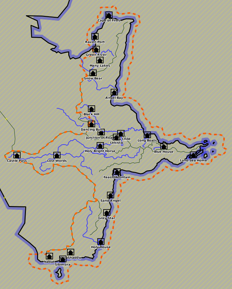
Here is Lekista in JOSM.
Senhar.
At some point while developing Ardisphere in 2015, I began thinking about Ardispherian religion. In the original, novelistic Ardisphere, religion and strange beliefs about psyche and the paranormal play a major role. But it’s largely “alien” and tied in with the aliens who intermingle in Ardispherian society. That was not an option for OGF Ardisphere. So since the aliens had become Koreans, it seemed logical for the alien religion to become … Buddhism. I created Gautamism as the OGF version of Buddhism, and made it the main religion in Ardisphere. Bear in mind that since the late 1990s, I myself have been a semi-practicing Buddhist, so this is not a stretch for me.
In OGF-world, though, names must be changed. And source places, too. I invented Senhar to be the home of OGF Buddhism, and began drawing maps of it offline. It is meant to be an equatorial island nation, modeled on Sri Lanka (not the real home of Buddhism on earth, but an important nation for the historical development of the religion nonetheless). But in the center of the large island I placed an extreme highlands (over 5000m), which would allow me to also include an OGF Tibet. Thus Senhar is a Sri Lanka / Tibet hybrid country. Since I have zero competence in the Tibetan and Sinhalese languages, I decided to go the conlang route, and invented a Senharian language that would be a bit based on Korean (which I do know) but written using Tibetan characters.
Here is a screenshot of Senhar from JOSM, which is where it exists for now, with incomplete contour work.
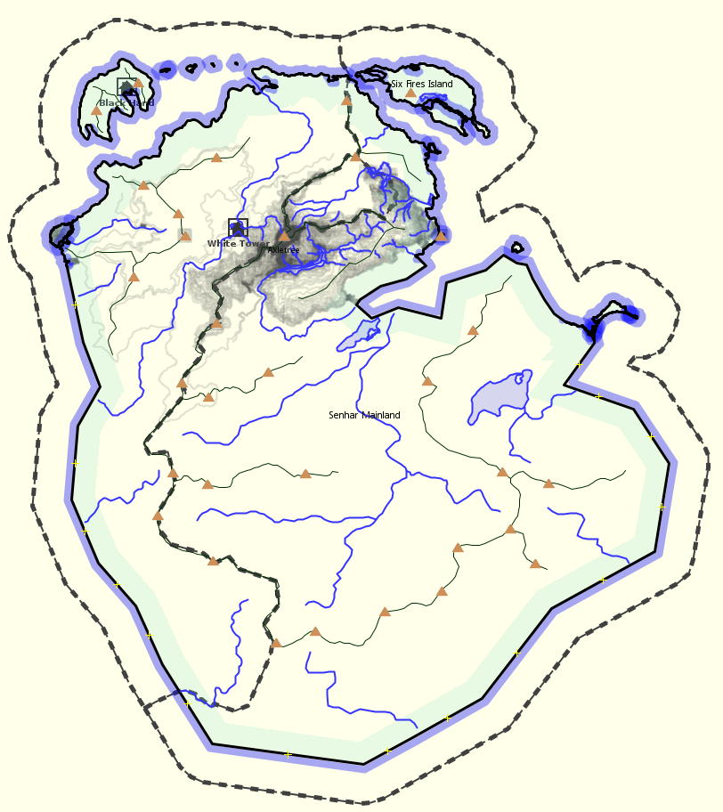
If anyone ever creates an OGF India, it would be my intention to petition admin, at that time, to allow me to place the island of Senhar off that country’s coast.
Tárrases.
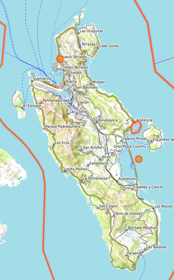
I created Tárrases exclusively because I felt I needed to try to make a microstate where I could focus and develop my mapping skills using JOSM and OGF. I wanted something I actually could “complete” in a reasonable amount of time. Secondarily, I wanted a place where I could allow my two main OGF societies to “meet.” Hence Tárrases was inspired by Spanish (Ardispherian) and Mahhalian cultures. I placed it as a libertarian enclave in dictatorial and theocratic Mahhal – a kind of Macau or Hong Kong to a Mahhalian China, in a geopolitical sense.
I believe Tárrases is my finest and best-developed geofiction to date – exactly as it was intended. I’m very proud of it.
As I was mapping it, I thought a lot about what kind of culture it was. I wanted something with maximal contrast to Mahhal’s rigidity, so I settled on a kind of libertarian-anarchist state. In fact, I was inspired by Tamarindia, which I pointed to at the beginning of this write-up. Tárrases was founded by pirates, who “stole” a Castellanese colony by making an unholy alliance with the Mahhalian aristocracy. They went “legit” and the Carapreta Dynasty, founded by the pirate Omar, has survived for over 200 years.
Here is Tárrases as currently drawn on OGF (and link to boundary relation):
Kshang.
I still believe in this project, but I’ve negected it hugely. I would someday hope to resurrect it in a more hospitable setting than hapless Rhododactylia.
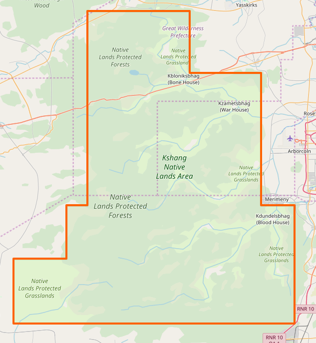
The Kshang are imagined as a parallel to one of the many ethnic groups in South Africa (since I’d decided somewhat arbitrarily that Rhododactylia was a kind of OGF South Africa, maybe).
I think in fact the Kshang began as a conlang, and the geofiction came later. It’s possible that I had a conlang that looked like Kshang even in high school. And I remember sketching maps for them, too, but they weren’t very detailed. It was meant to be a pre-modern society. But I know Kbloniksbhag (Bone House) was the “capital,” such as it was. I spent more time developing the Kshang religion and culture, and thinking about life in a traditional Kshang village.
I think my effort to place the Kshang as a major ethnic group in Rhododactylia was a failure – mostly because I lost hope of that country ever being in any way a coherent geofiction at all.
They need a home of their own, a little OGF Botswana or something.
Here is Kshang as currently drawn on OGF (and link to boundary relation):
Bofobunda.
I invented Bofobunda in 2016 (I think) at a point in time when I was thinking of a way to make West Commonia culturally interesting, in the way Gobrassanya is interesting. I had orchestrated the “divorce” of West Commonia from Commonia, and so I had intended to place some mapping there. I wanted a stand-alone project, so I created the Bofobundans.
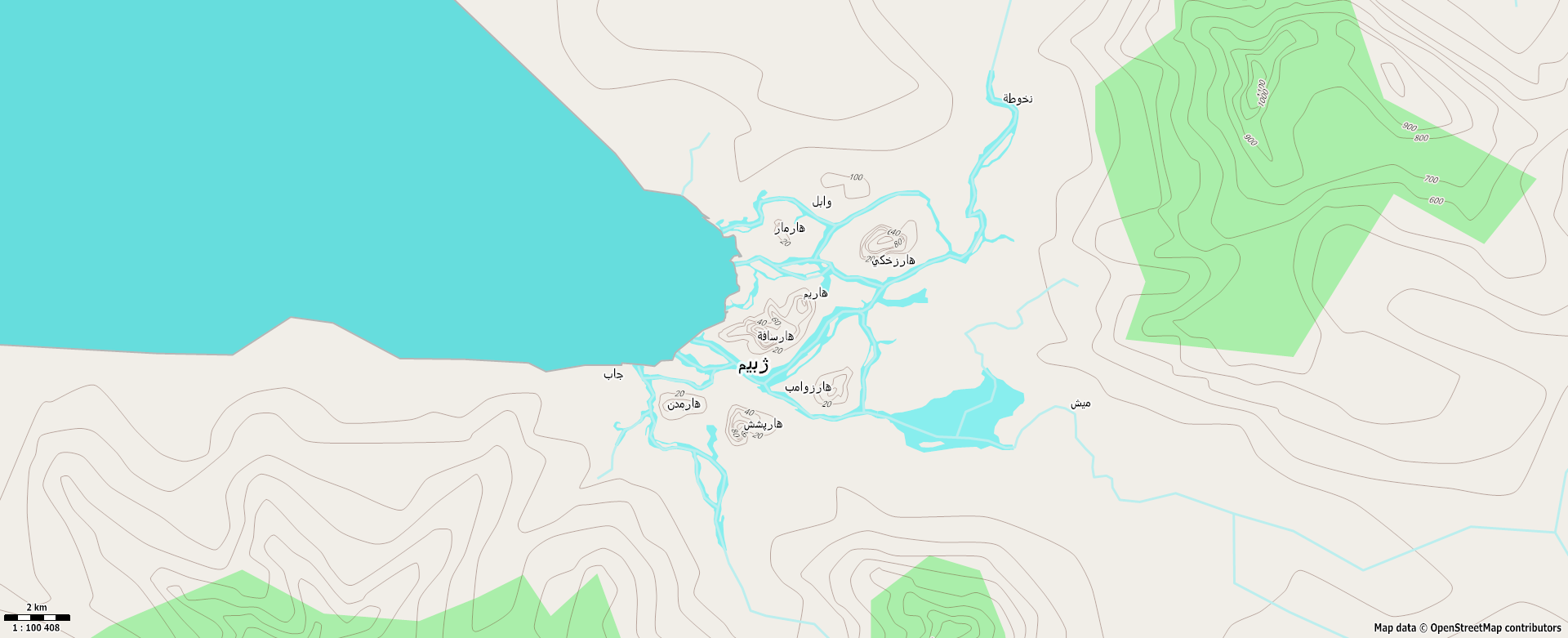
I got distracted by their language and culture, something vaguely southeast Asian but with a conlang written with the Farsi (modified Arabic) script. So I never uploaded any of the mapping to West Commonia. And I’m glad I didn’t – someone would have surely destroyed it beyond recognition by now.
I “rescued” the Bofobundan culture from obscurity by placing them as a small minority in Ardisphere, with a concentration of population at the city of Lagartopolis, where they have a large, famous mosque. I would like to work on that more.
Their home country remains unmapped. Here is the capital of Bofobundah, the city of Zhebeyem. This was my first experiment with contours and maperitive – a largely failed experiment.
Makaska.
Makaska is my newest OGF project. Currently, I view its success as second only to Tárrases, and on a much larger scale. Unlike Tárrases, it’s far from finished.
Like Tárrases, I think Makaska has been successful partly because I created it for OGF. It’s OGF-specific, and thus I don’t feel any regrets about editing out any formerly existing inverisimilitudinous elements, due to OGF’s rules.
Once I’d kicked off the FSA project, I began thinking about how I could participate by taking on my own state, on the principle of “lead by example.” I wanted to make an exemplar FSA state. My thoughts turned to my years living in Minnesota. I had studied the Dakota language in college, there, and since I wanted my FSA state to have a strong “native” presence, and I wanted it to feel authentic, an OGF Minnesota seemed logical. I pulled out my trusty English-Dakota dictionary from college, and got started making up names.
So far, I’m happy with it. It’s a work-in-progress, and is my main “active” geofiction, right now.
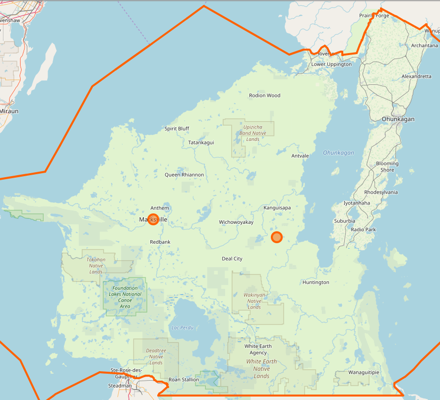
Here is Makaska as currently drawn on OGF (and link to boundary relation):
Deadlands.
The Deadlands is not the same as the other geofiction projects, above. The background is that for a while while living in Korea, I resurrected an old habit I had from the late 1980s – I started playing MUDs (text-based computer role-playing games). But when I started maintaining my own Linux server in 2016, I went further. I decided I should build my own MUD.
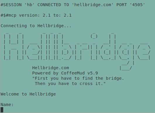
So I started to. It’s currently offline, regrettably. It’s called Hellbridge, and it’s a post-apocalyptic/fantasy hybrid that takes place in an inverisimilitudinous setting called The Deadlands. Here is a screenshot of the Hellbridge MUD login.
My intention was to actively integrate the OSM-style slippy map with the game, so that players could follow their progress in the game world with a marker on the website map. So I have been experimenting with non-standard tagging of nodes that I could tie into the MUD database through some kind of customized database procedure, such that a character’s “current location” could be tied to a pin on the map, google-maps style.
Here is a map window (leaflet) with a test marker, showing the map-in-progress of the village of Goodgrove – intended to be one of the “starter villages” for new characters exploring the Hellbridge universe.
I don’t know what made me write all this, just now. Perhaps I grew tired of typing out the same explanations over and over on the OGFC Discord, or in conversations in the OGF Forums and diaries. So now I can just point people here. I might add to this write up with more detail over time.
Music to do meta-geofiction to: Apoptygma Berzerk, “Kathy’s Song.”
