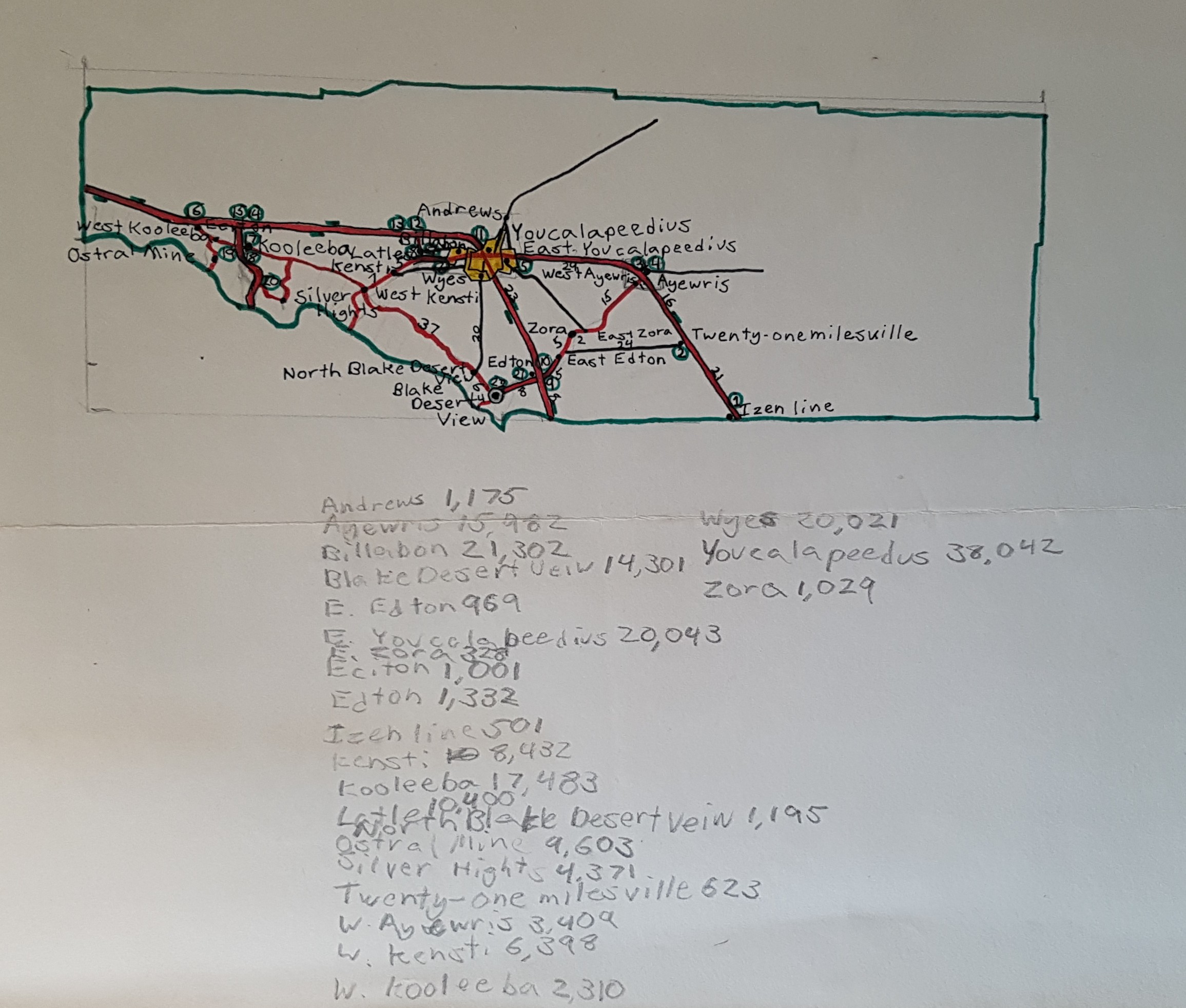
This is a map of Youcalapeedus County, in some imaginary intermountain state. I drew this when I was 10 years old, I think. Maybe 11. I had worked out the population for each of the towns. The area is high desert, perhaps based on one too many family trips driving across Nevada.
I like the name Twenty-one-milesville.

