Yojándara

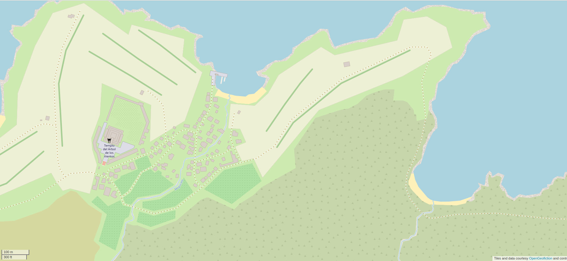
My low-effort brag-post for this week is a pre-colonial coastal village called Yojándara, in the country called Ardesfera. It is near to the city of Arbaronga, on an island just off the coast. In the “present day” (modern era) this is a tourist-oriented area near the big city, reachable by ferry, with a quaint village and restored ruins. The mapping of the area currently on the map, seen here, is a historical snapshot at around 1450, before the Ulethan colonists from Ingerland and Castellan showed up.

Screenshot of the map window on the OpenGeofiction site, showing an area mapped of an area on a seashore, with lots of detail, including a village and a temple

This neighborhood is found on the opengeofiction map here: https://opengeofiction.net/#map=17/-24.42120/123.90046&layers=B

Arbaronga

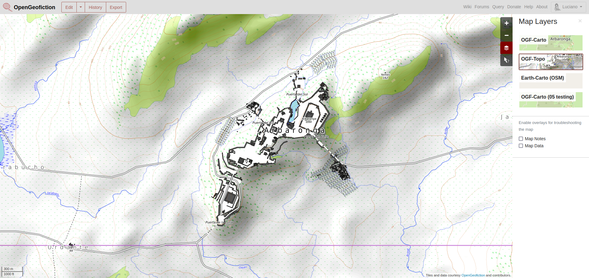
My low-effort brag-post for this week is a pre-colonial hilltop fortress city called Arbaronga, in the country called Ardesfera. In the “present day” (modern era) this is not far from the center of the vast metropolis of Villa Constitución, which is the capital and largest city of Ardesfera. The fortress city remains as a grouping of restored ruins, a historical tourist attraction. The mapping of the city currently on the map, seen here, is a snapshot at around 1450, before the Ulethan colonists from Ingerland and Castellan showed up. The fortress area at the hilltop is mostly complete, but I haven’t mapped much of the surrounding area, meant to be covered in intensive agriculture. In the modern era, this is all city.

Screenshot of the map window on the OpenGeofiction site, showing an area mapped in the

This neighborhood is found on the opengeofiction map here: https://opengeofiction.net/#map=15/-24.3398/123.7518&layers=V

MundoMar

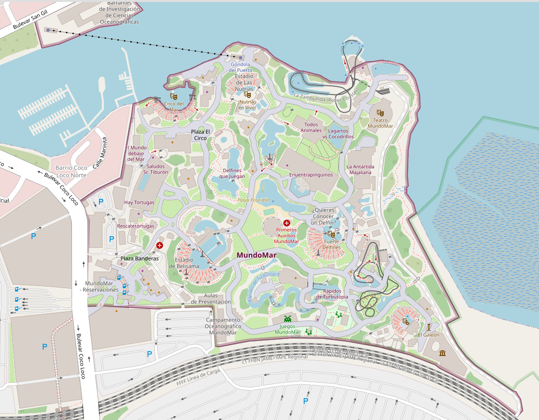
My low-effort geofiction bragpost for the week is a theme park called MundoMar in the country of Ardesfera.

I’m not  as good at what’s called detailed or micro-mapping, but I thought this was a good effort. It’s a maritime-themed theme park, maybe somewhat modeled on Sea World – though I haven’t visited Sea World in about 50 years.

The surroundings to the theme park are not as well mapped, and the farther afield you go, the more embarrassed I am by the work. Much of this mapping is from my first year on the opengeofiction site (2014), when I was still learning how to use the tools and figuring out what was possible in the realm of “slippy map geofiction”.

Here is a screenshot of the spot:

Screenshot of the map window on the OpenGeofiction site, showing an area mapped of a theme park called MundoMar with lots of detail.

The area shown is here on the map server: https://opengeofiction.net/#map=17/-24.47490/124.33675&layers=B

Quelepa

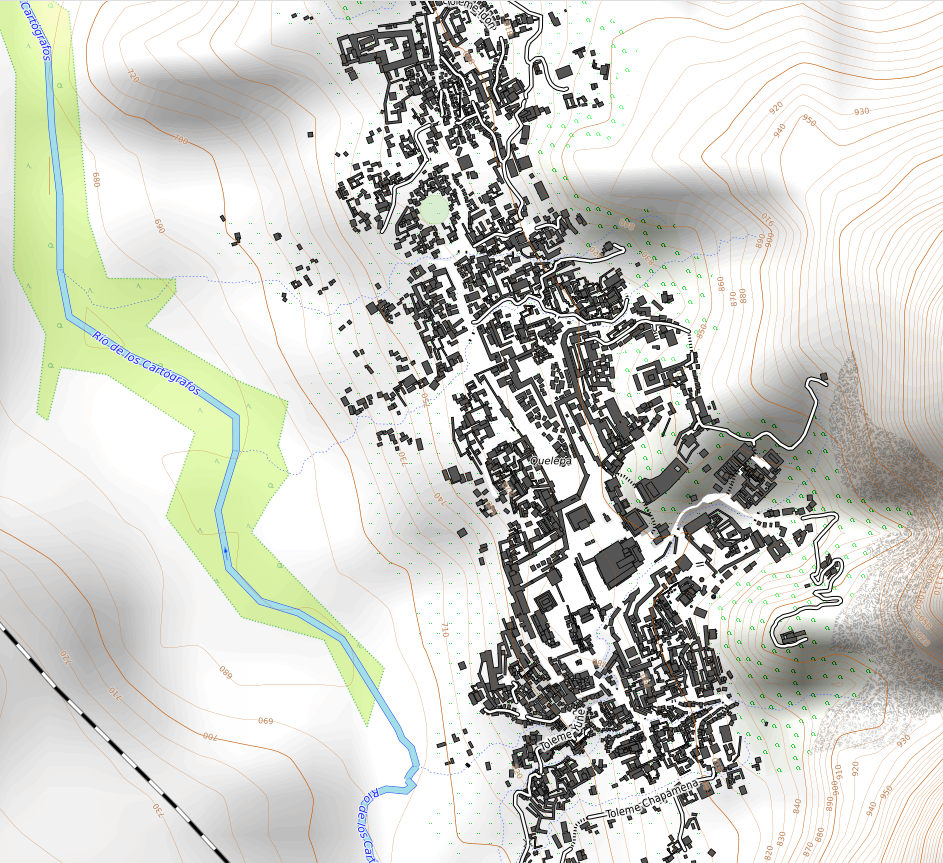
For this week’s low-effort bragpost, I’m sharing my pre-modern ceremonial capital, Quelepa. The plan that I had, long ago, was to create this circa 1400’s city, in the style of maybe a Mayan or Aztec city, and then overlay a modern city over it, using a historical mapping process. But I never got around to it, so the city is still there, in a kind of anachronistic reservation within the otherwise modern country of Ardesfera. That explains the bit of railroad seen in the lower left of the screenshot.

I was especially pleased with the city because it conformed to the already-drawn contours (topo) for the region. I also did some minor work on a conlang for the culture involved, which I used to name all the various temples included.

A screenshot of the zoomable map on the OpenGeofiction.net website, showing a pre-modern ceremonial city with detailed buildings and walls, and a background showing the contour lines of the area's physical topography.

Here is a link to the zoomable map: https://opengeofiction.net/#map=16/-21.7931/121.6496&layers=V

Provincia de Amor

As I said last week – I’m going to try to do a low-effort post of past or current geofiction work once a week.

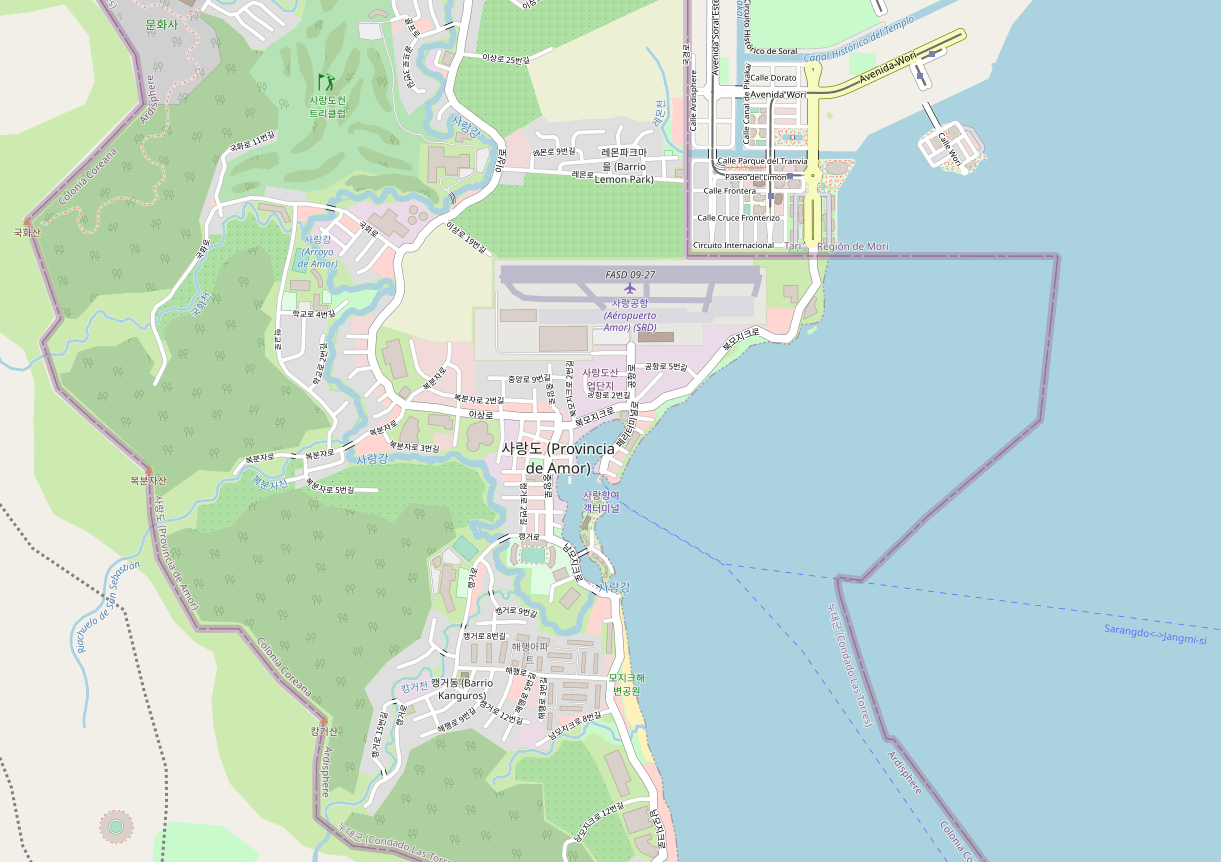
For this week, I’ve been feeling nostalgic for my years living in South Korea. So I decided to post a geofiction I did while living there, in 2015 or so. It’s not the greatest – there are aspects I can even say I feel a bit embarrassed by, but at the time it was the best I’d done so far, and I was quite happy with it.

Screenshot of a map of an imaginary place called Sarang-do, hosted on the OpenGeofiction map server

Here’s the link to the map: https://opengeofiction.net/#map=15/-20.7997/124.2137&layers=B

It’s a little bit tongue-in-cheek, linguistically. My Korean language skill isn’t that good, so the naming is probably amusing or cringey for those who are better with Korean. The whole idea is that this is a quite small, touristically-oriented, Korean-speaking exclave of my imaginary country called Ardesfera (Ardisphere). Bear, in mind, therefore, that anything outside of Sarang-do’s borders is not my work – and there’s been quite a bit of turnover by the neighbors, too, so I don’t actually know who’s currently mapping in the surroundings nor what their concept is – it’s clearly incomplete.

Subway Philosophy

Someday, I will return to work on my great metropolis, Villa Constitución. And when that day comes, I shall take on the huge project of refactoring the complex subway system I designed.

When designing subways, one should have a philosophy of subways in mind. Here is an essay every subway designer must read: “Stoppism: Retrospects and Prospects“.*

*Footnote for the dense: the linked article is satire – a gorgeous, brilliant joke.

Music to design subways by: Silvio Rodríguez, “Santiago de Chile.”