Font Fail

As usual, I have neglected this blog. So what’s been going on?

I have taken some steps to migrate one of my major geofictions – The Ardisphere – from OGF to my self-hosted OGFish clone, Arhet. The reason for this is that OGF seems increasingly rudderless and destined to eventually crash and burn, and I am emulating the proverbial rat on the sinking ship. I still hugely value the community there. But the backups have become unreliable, the topo layer (of which I was one of the main and most expert users) has been indefinitely disabled, and conceptual space for innovation remains unavailable.

One small problem that I’ve run up against in migrating The Ardisphere to Arhet is that I discovered that Korean characters were not being supported correctly by the main Arhet map render, called arhet-carto. This is a problem because the Ardisphere is a multilingual polity, and Korean (dubbed Gohangukian) is one of the major languages in use, second only to the country’s lingua-franca, Spanish (dubbed Castellanese). I spent nearly two days trying to repair this Korean font problem. I think I have been successful. I had to manually re-install the Google noto set of fonts – noto is notorious (get it?) for being the most exhaustive font collection freely available. I don’t get why the original install failed to get everything – I suspect it’s an Ubuntu (linux) package maintenance problem, rather than anything directly related to the render engine (called renderd, and discussed in other, long-ago entries on this sparsely-edited blog).

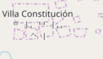
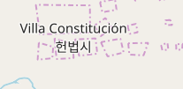
Here (below) are before-and-after screenshot details of a specific city name that showed the problem: Villa Constitución (헌법시) is the capital and largest city in The Ardisphere. Ignore the weird border-artifacts behind the name on these map fragments – the city is in limbo, right now, as I was re-creating it and it got stuck in an unfinished state.

Before – you can see the Korean (hangul) is “scattered”:

picture

After – now the hangul is properly-composited:

picture

You can see The Ardisphere on Arhet here – and note that within the Arhet webpage you can switch layers to OGF and see it there too. Same country, different planets!

Music to fiddle fonts by: Attack Attack! “Brachyura Bombshell”

The Terrible mysql Crash of 2021

I still don’t know how it happened. I somewhat suspect I got hacked, somehow … I found strange and unexpected Chinese IP addresses in my mysql error log. But I don’t understand mysql back end or admin well enough to know for sure what was going on.

I was able to restore a full-server backup to a new server instance, and have re-enabled the mysql-driven websites (my 2 blogs, my wiki, etc.) on the new instance. Meanwhile, I somewhat stupidly reactivated the non-mysql website (the geofictician OSM-style mapping site, the so-called “rails port”) on the old server instance. The consequence of that is that I am now stuck with a two-server configuration where I had a single server configuration before. I think in the long run I’ll want to isolate ALL my mysql-based sites to a single server, and ALL my non-mysql-based sites to another single server. That’s going to take a lot of shuffling things around, which is not trivial.

For now this blog (and my other blog) seems healthy and up-and-running, again.

There may be more downtime ahead as I try to reconfigure things more logically, however.

Music to do sysadmin drudgery by: Talking Heads, “Found A Job.”

Blocks and more blocks

I keep on with my many small steps approach to Ohunkagan. I feel it becoming mythical in my mind and memory. I imagine the corners where scenes take place in unwritten novels, the streetcars characters ride to well-mapped destinations.
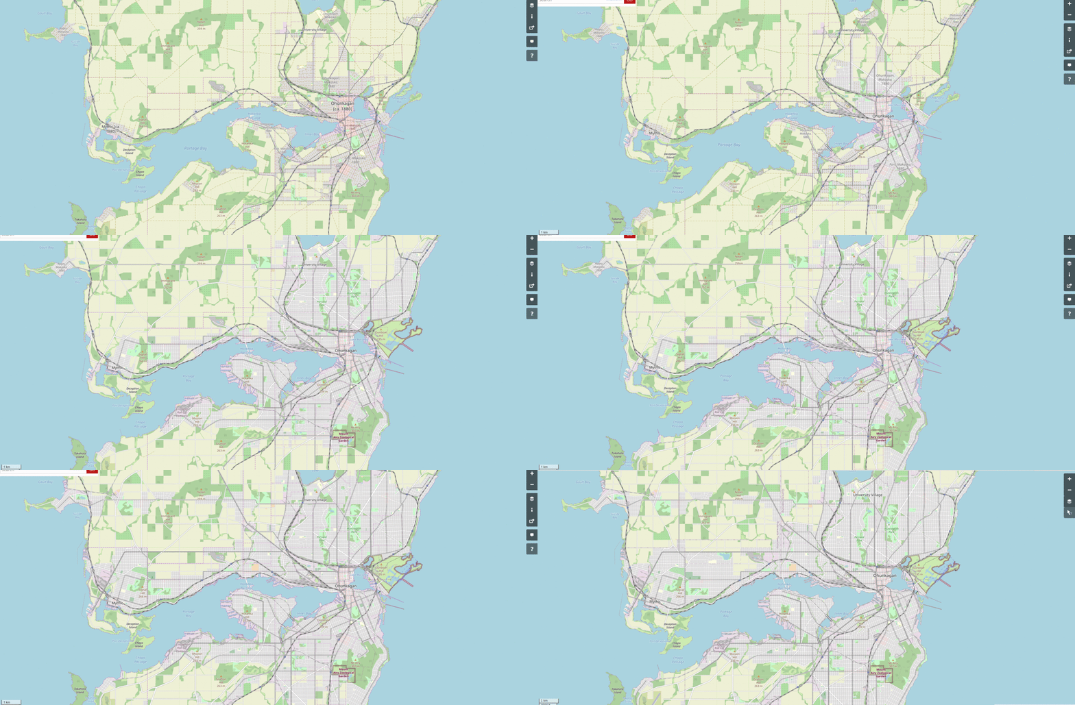
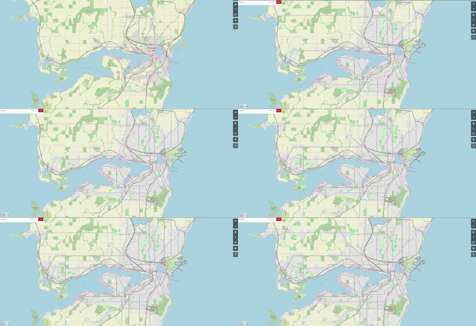
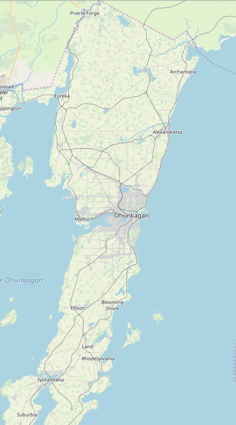
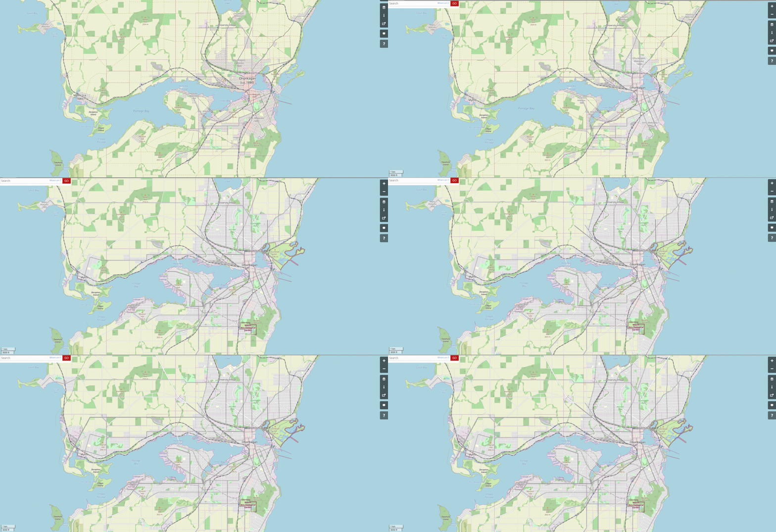
I’ve updated the “work-in-progress” gif.

picture


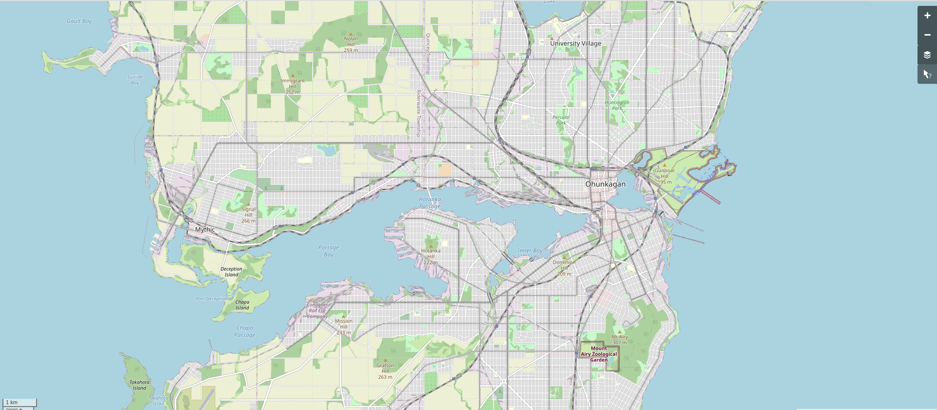
Here is the current snapshot, let’s call it 1907.

picture

[Technical note: screenshot taken at this URL (for future screenshots to match).]

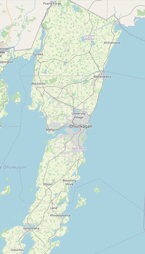
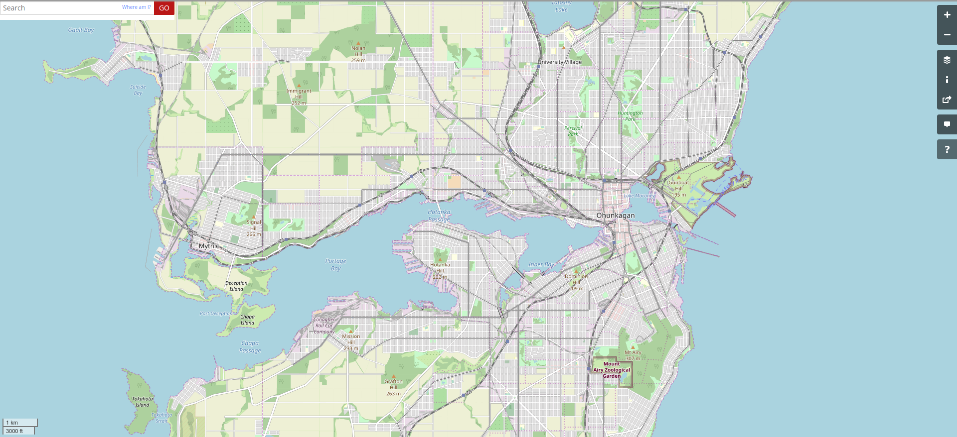
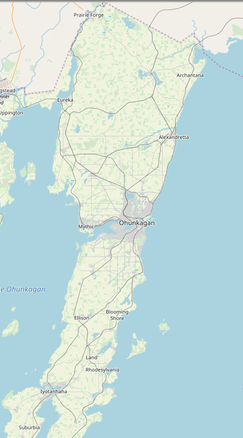
Here’s the wider area snapshot.

picture

[Technical note: screenshot taken at this URL (for future screenshots to match).]

Music to map by: Arvo Pärt, “Tabula rasa.”

More Ohunk Than Evar

I keep doing small edits for Ohunkagan Metropolitan Area. I’m up to the year 1904 or so.

I made this cool gif of the progress so far:

picture

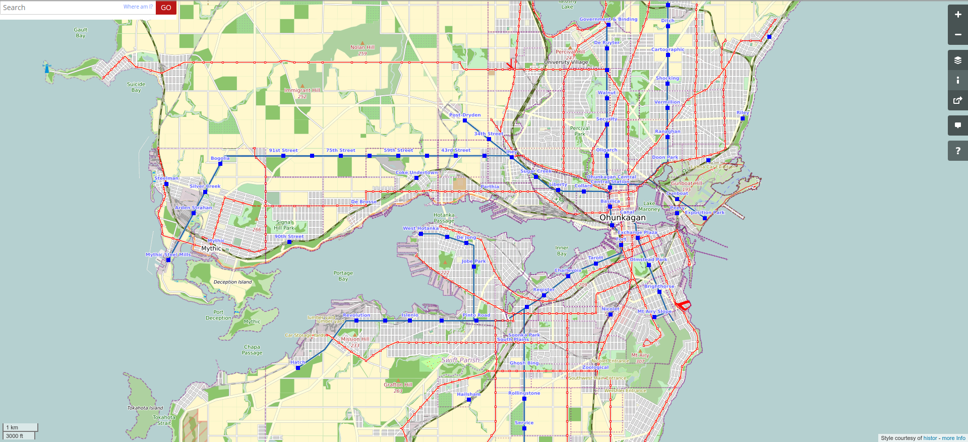
Here’s the transit network, on the same frame:

picture

Here is a wider area view – I’m going to start a time series of screenshots for these, too, to show the growth of the metropolitan area.


picture

I have been placing lots of industry and factories and such. I’m most proud of the rail-car factory, here.

Music to map by: HAUJOBB, “Dead Market.”

Round and round

I’m sorry I neglected this blog for the last two months. It wasn’t because I stopped geofiction activities – I just kind of forgot to update anything here. In fact, I’ve been staying busy with various geofiction projects.

I ran across a small, free website that someone made that transforms a flat map of an imaginary planet into a globe that you can rotate with the mouse or that can be used to generate a “spinning world” gif. It’s called maptoglobe.com.

I decided I wanted to make one for my planet, Arhet – just out of curiosity. This did have a few minor technical challenges. First, I had to “knit” together the tile images for Arhet. I found a nice utility that does this, an application called tile-stitch by Eric Fischer. It can be found on github. Except for one small problem, I just followed the documentation provided on the github README. That one problem: to get it to work in my machine, I needed to modify the code in the stitch.c file to include the full path to the geotiff utilities. So…

Original code:...

#include <geotiffio.h>
#include <xtiffio.h>
...

My version:...

#include </usr/include/geotiff/geotiffio.h>
#include </usr/include/geotiff/xtiffio.h>
...

Once that was set up, I simply extracted the tiles at zoom level 5 from the Arhet2-carto render using the tile-stitch utility, with this command
./stitch -o arhet5.png -- -85.05 -179.99 85.05 179.99 5 https://tiles01.rent-a-planet.com/arhet2-carto/{z}/{x}/{y}.png

That got the whole planet into a square .png file, which I called arhet5.png.

The next problem is that the maptoglobe website requires the map image to be in a equirectangular projection. But the tiles for Arhet are in the modified mercator projection used by almost all online “slippy maps,” classified as EPSG:3857.

So the arhet5.png file was in the wrong projection. I found out I could use another utility that I already had, the gdal library, to do this job. I ran the following commands.
/usr/bin/gdal_translate -of Gtiff -co "tfw=yes" -a_ullr -20037508.3427892 20036051.9193368 20037508.3427892 -20036051.9193368 -a_srs "EPSG:3857" "arhet5.png" "arhet5_tfw.tiff"

/usr/bin/gdalwarp -s_srs EPSG:3857 -t_srs EPSG:4326 -ts 6400 3200 "arhet5_tfw.tiff" "arhet5.tif"

These produced a .tif file in the right projection, 6400 x 3200 pixels. I then opened this file and resaved as .png again (because this is a more compact format that is therefore uploadable to maptoglobe.com – which has a maximum file size limit).

I then uploaded that .png file to the maptoglobe site, and it allowed me to save the resulting “globe” – it’s accessible here. Further, I was able to make this nice little spinning planet gif:

That’s the planet Arhet, as it currently stands – note that most of the mapping there is not my own, but the work of the various other Arhet members who have joined me in my experiment.

That worked out so well that I did the same thing for my own private planet, Rahet (note that the names Arhet and Rahet are obviously related; Rahet came first, and when I decided to change the project and invite other participants, I renamed the old Rahet as Arhet, and then resurrected the old Rahet later and as a separate project again).

Here is a the link for Rahet on the maptoglobe site, and here is the spinning planet gif:

So those are pretty cool. Remember that the original “slippy maps” (HRATEs) of these two projects are on the map portion of this website, here and here.

Music to make HRATEs to: 하선호 (Sandy), “Love Me More”

My Paper Geofiction #31

This is the “canonical” map of Tsiqeye (Ciiquia) – the oldest continent on the planet Rahet. I did this in 1980, and took it down to the photocopy shop and made 100 copies, and then drew a “historical” series showing the evolution of borders between nations, empires, tribes – over a 4000 or 5000 year span. I don’t think I preserved those sketches. At the time, I didn’t see them as needing preservation – they were just “work in progress” for the history I was developing. I think I had the idea I was going to produce a historical atlas for Rahet, but these were just preliminary drafts and experiments.

This canonical shape of Tsiqeye is somewhat preserved in recent sketches I’ve done of Rahet (e.g. the online map). The most significant change is in the way the continental landmass extends south to the South Pole. Now that I’ve found this old canonical map, I may try to merge it with the current online version (which was drawn from memory before I found all my old paper maps).

picture

My Paper Geofiction #30

This is rather impressionistic map of a continent that was clearly never finished. I can’t even guess a date, but would estimate middle school or high school. I don’t what name it might have had – or if it even had one at all.

picture

My Paper Geofiction #28

This is a quite early map. I’m guessing 1975 or 76, based on some of the place names – for “New Vancouver”, “Koroff”, and “San Oso” (Saint Bear! Hah…) I remember attempting city maps as well.

I have a vague memory of perhaps working on this map during a road trip. The paper on clipboard or something, on my lap, and markers at my side, letting the vibration of the road influence the coastlines.

picture