I continue to be really busy with work, so I don’t have a lot of time for mapping or server stuff.
I have been progressing further on Makaska. The hydrology is pleasing, and contours feel like they’re falling into place and that it will be possible to actually finish them in a finite amount of time.
Another thing that needs working on to make a truly “US analogue” midwestern state such as Makaska, is that there need to be realistic county and township divisions. This means replicating the kinds of the errors and styles of 19th century “compass and chain” survey methods.
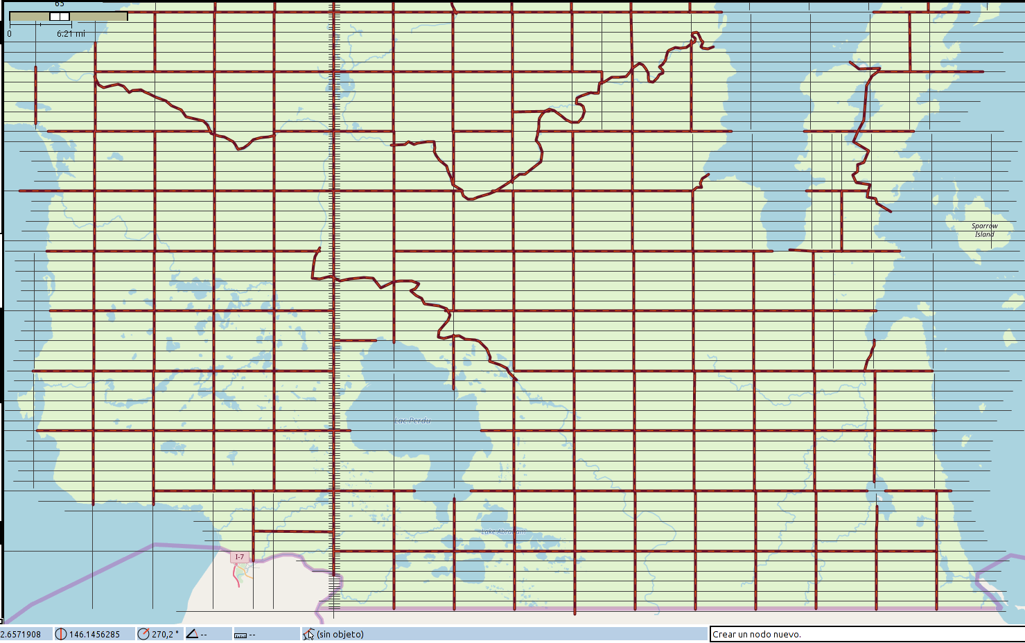
I am quite pleased with my results – not yet uploaded because I want to make sure the townships I’ve laid out are in sync with my ideas about where the rivers and county lines will go and I want everything to have a name, of course. Anyway, here is a screenshot in JOSM.
My title refers to the fact that the 19th century North American grid style was based on the mile, which is 5280 feet. A standard township was made up of 36 “sections”, 6 miles by 6 miles square. Each “section” was divided into quarters (160 acres, 2640 feet to a side) and those were further divided into “quarter quarters” (40 acres, 1320 feet to side). So in recreating the survey process for my fictional place, I “paced” my way across my entire state in 1320 foot lengths, imagining my surveyors stretching out their chain over and over. By doing it this way, I could introduce random “mistakes” that would render the result realistic, and I could account for the way the curvature of the earth forces periodic resets of the alignments of the north-south meridian lines.
So my grid contains these inconsistencies, and in a few places, I have deliberately failed to “walk” perfectly north/south/east/west, forcing a later realignment.
In the picture above, the little “tic marks” on the north-south “base meridian” are 1320 feet apart.
Music to map by: 블락비, “닐리리 맘보.”

