Field work for mapping Ohunkagan

I haven’t mapped anything, these last two weeks. But I thought about mapping a lot. That’s because I spent the last two weeks in Seattle and Portland for a family emergency, driving around and thus getting lots of ideas and thoughts for Makaska. Certainly I had already been intending the main metropolis, Ohunkagan, to have some similarities with Seattle (although with a Minnesota climate), situated as it is on an isthmus, but getting to drive around there and around Portland, too, gave me some more ideas, anyway. Call it a kind of “Field research” for eventual mapping.

This is a pretty short entry, then, just to give an update of what I’m up to on the geofiction front.

Now that I’m back in Korea, I may have some more time and opportunity to do more mapping.

Music to map by: Taylor Swift, “Delicate.”

Lakes

I have been working quite a bit on my fictional “US” state, Makaska. But for the most part I am focused on physical geography: refinining the contour files (a continuous work-in-progress), and thinking about the hydrology (rivers and lakes) and landcover (grasslands and woods).

I did set up 2nd order political divisions (counties) which I have decided to call parishes. And I set up a moribund rural township system which will drive things like road layout, farms, etc., when the time comes, and which is intended to replicate the old US PLSS system (see also my previous blog post here). The townships will also be the basis for my landcover relations – a six mile square seems about the right level of scale for a specific landcover relation, not so big as to be unmanageable once a high level of detail is introduced, but not to local so as to be difficult to develop systematically.

I’m pretty happy with the map already. There are so many lakes! And I’m just getting started. Minnesota allegedly has 10,000 lakes – in fact, it’s quite a lot more than that, from what I’ve heard, but that’s the round number used when marketing the state, and if you impose a cut-off at lakes around the size of 5 acres, 10,000 is pretty close.

I suppose I could shoot for a pro-rated number of lakes for the much smaller Makaska. If Minnesota has 10,000 at 86,936 sq mi, that’s 0.11 lakes/sq mi. So if Makaska has 6875 sq mi, then it should have 756 lakes of 5 acres or more. I may be getting close to that already.

Music to map by:  Control Machete, “Andamos Armados.”

1320 feet

I continue to be really busy with work, so I don’t have a lot of time for mapping or server stuff.

I have been progressing further on Makaska. The hydrology is pleasing, and contours feel like they’re falling into place and that it will be possible to actually finish them in a finite amount of time.

Another thing that needs working on to make a truly “US analogue” midwestern state such as Makaska, is that there need to be realistic county and township divisions. This means replicating the kinds of the errors and styles of 19th century “compass and chain” survey methods.

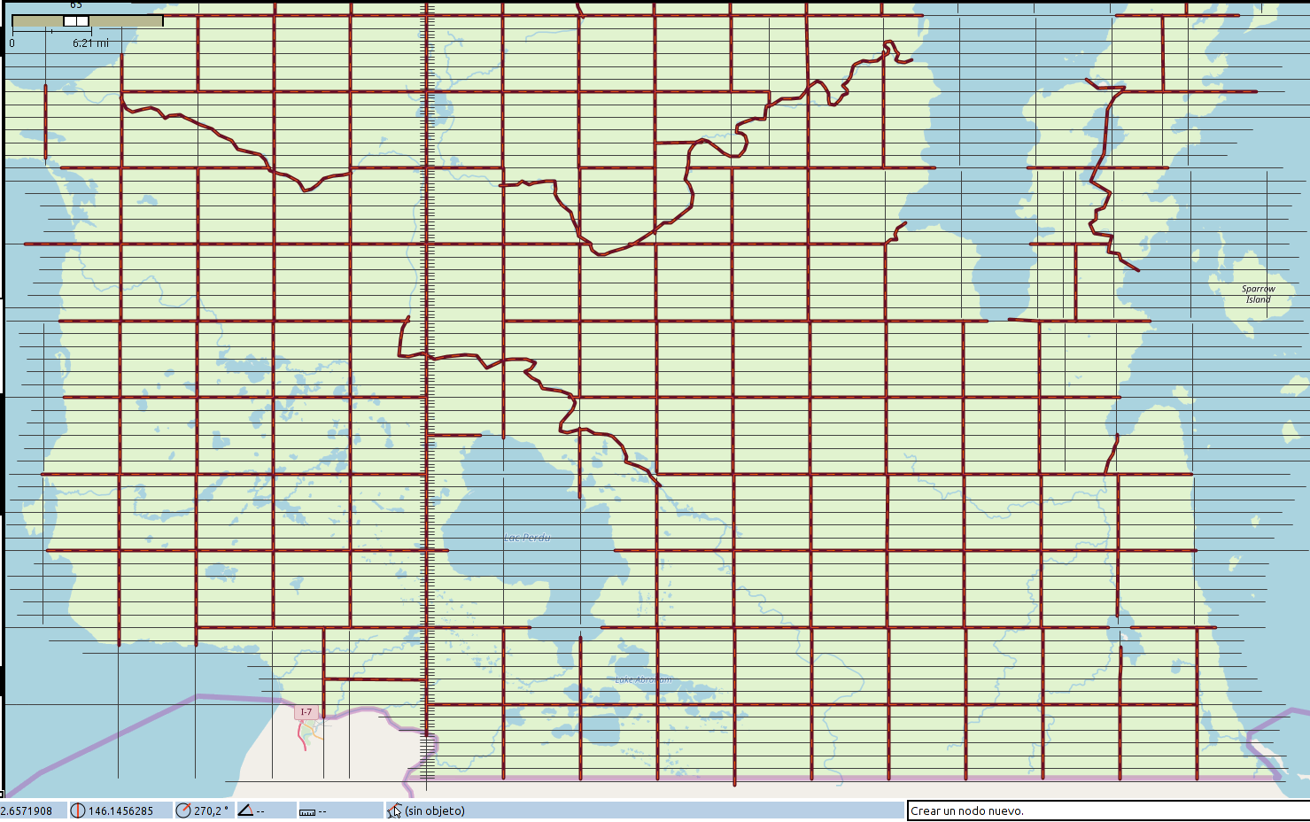
I am quite pleased with my results – not yet uploaded because I want to make sure the townships I’ve laid out are in sync with my ideas about where the rivers and county lines will go and I want everything to have a name, of course. Anyway, here is a screenshot in JOSM.
picture

My title refers to the fact that the 19th century North American grid style was based on the mile, which is 5280 feet. A standard township was made up of 36 “sections”, 6 miles by 6 miles square. Each “section” was divided into quarters (160 acres, 2640 feet to a side) and those were further divided into “quarter quarters” (40 acres, 1320 feet to side). So in recreating the survey process for my fictional place, I “paced” my way across my entire state in 1320 foot lengths, imagining my surveyors stretching out their chain over and over. By doing it this way, I could introduce random “mistakes” that would render the result realistic, and I could account for the way the curvature of the earth forces periodic resets of the alignments of the north-south meridian lines.

So my grid contains these inconsistencies, and in a few places, I have deliberately failed to “walk” perfectly north/south/east/west, forcing a later realignment.

In the picture above, the little “tic marks” on the north-south “base meridian” are 1320 feet apart.

Music to map by: 블락비, “닐리리 맘보.”
Makaska

Work has been quite rough, lately. So I haven’t done much of anything geofictional.

However, isleño recently took AR120 “live” in OGF. AR120 is meant to be a kind of OGF version of the US. And I had long planned to make a state in this country. I gave up the vast majority of my territory in Mahhal (returning it to the unused country pool as AN160e) and exchanged it for a smallish “Great Lakes” state. This state will be Makaska.

Makaska is roughly modeled on Minnesota, and other upper midwest locations (Wisconsin, Michigan, Dakotas). It has a large, isthmic metropolis, called Ohunkagan – this is real-world Dakota language, which I studied once, long ago. Many of the place-names in Makaska will be from Dakota, including the actual state’s name.

I have actually done a lot of work on Makaska. But its shape was vague because I wasn’t sure which location I would get in OGF to implement it. So it was kind of schematic, with all these fragments of contour sections, hydrology, counties, etc.

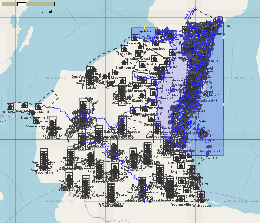
Now I’ve begun the work of adapting these schemata to its actual location. I have more than 10 different JOSM layers, and I go back and forth, adjusting a river, rearranging some towns, etc. I used JOSM’s opendata plugin to upload about 300 placenames directly from a spreadsheet where I’d been working on them. So that’s a start.

Here’s a screenshot of the work-in-progress.

picture

Music to map by: Niloo, “Ola Ola.”