HRATE

In response to several queries from other geoficticians about how to set up a map server (e.g. Arhet or Ogieff), I decided to consolidate some documentation about how I got Arhet to work. It is here:

http://wiki.geofictician.net/wiki/index.php/HRATE

It is very much a work-in-progress. As I think of information to add, or decide to add more detail, I’ll fill it out. At some point, I’ll be trying to do a “re-build” of the Arhet stack to a new server (for reasons related to the fact that I have other things running on its current server that have a higher need for reliability), and when I do that, it will give me a chance to review and better understand the process.

Music to write documentation by: Erik Satie, “Gnossienne No. 1, 2, 3.”

Mission Statement

The point is clear: the purpose of the Organization is to be organized.

Several committees will have been created to pursue this goal, with necessary but not sufficient technocratic support staff.

The Committee and Directorate of Teleological Debate (for All Intents and Purposes)

This committee and associated support staff attempts to address the question, Why does the Organization exist? Is the ongoing organization of such organizations as this Organization strictly necessary? Importantly, it advocates that a main purpose of the Organization is to discuss (but avoid resolving) such questions.

The Committee and Directorate of (Mis-)Direction

This committee and associated support staff attempts to address the question, Who controls the Organization? How is this control (if it exists) implicated in processes of organizational creation and perpetuation? Is it possible for the various committees and directorates of the Organization to accomplish their goals without direction? Is direction perhaps inimical to the Organization?

The Committee and Directorate of Cryptic Origins

This committee and associated support staff attempts to address the question, To what extent are the demiurges behind our perceived reality (this knowable Ardisphere beneath our feet) actually more real? More troubling, what are these demiurges’ motives? Are they a unified front, or a disparate group operating at cross-purposes? What are their origins? And to what extent do they wilfully misrepresent their true motives and origins?

The Committee and Directorate of Semiotic Action

This committee and associated support staff attempts to address the question, How can the Organization best emit a maximum proportion of signs to actual meaning? How best can the resources available (e.g. diaries, newscasters, hermetic hypertexts and encyclopedic simulacra) be leveraged to increase the full coverage of the Known Universe with (and by) content-free organizational representations?

Music to organize to: Mexican Institute of Sound, “Mi negra a bailal.”
Maps Marker Test

Trying to test the “maps marker plugin” for use with my Hellbridge MUD worldmap. I’m feeling skeptical that I can make use of it.

[UPDATE 20210530: This maps marker plugin has stopped working. They want money to “upgrade” to some paid version. Nuh-uh. Therefore… well, here’s an alternate way to put a marker, but I don’t know if it could work for my Hellbridge project or not.]

Marker
300 m
1000 ft
Leaflet, © OpenGeofiction contributors

Music to test wordpress plugins to: Loreena McKennitt “Bonny Portmore”

Longtime Geofictioning

Arhet remains a work-in-progress. I’ve come up with two not necessarily incompatible tag-lines for the project:

  1. “Imaginary real estate doesn’t need to be a scarce resource.”
  2. “Sometimes you want to just toss verisimilitude out the window and map something crazy!”

I’ve been working on a kind of side-project, where I’m trying to get my MUD, called Hellbridge, to expose player location information to some kind of API or queryable dataset, such that I could then use something like a multimaps window in the wiki or wordpress to show player location on a map. This is a customization of the out-of-the-box CoffeeMUD platform I’m trying to use, and my Java programming skills are non-existent, which makes it difficult, but it would be a cool and unique feature if I could get it to work.

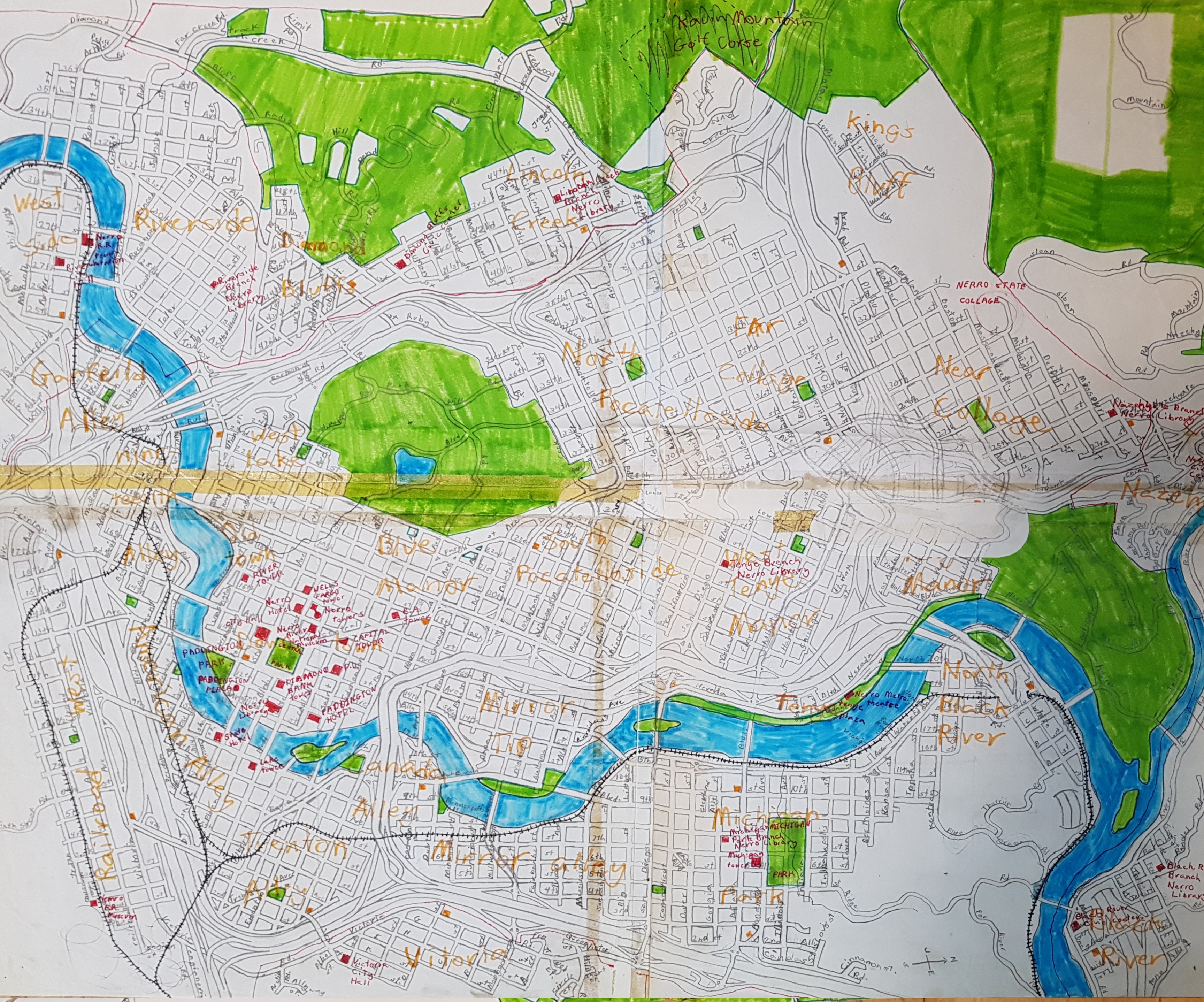
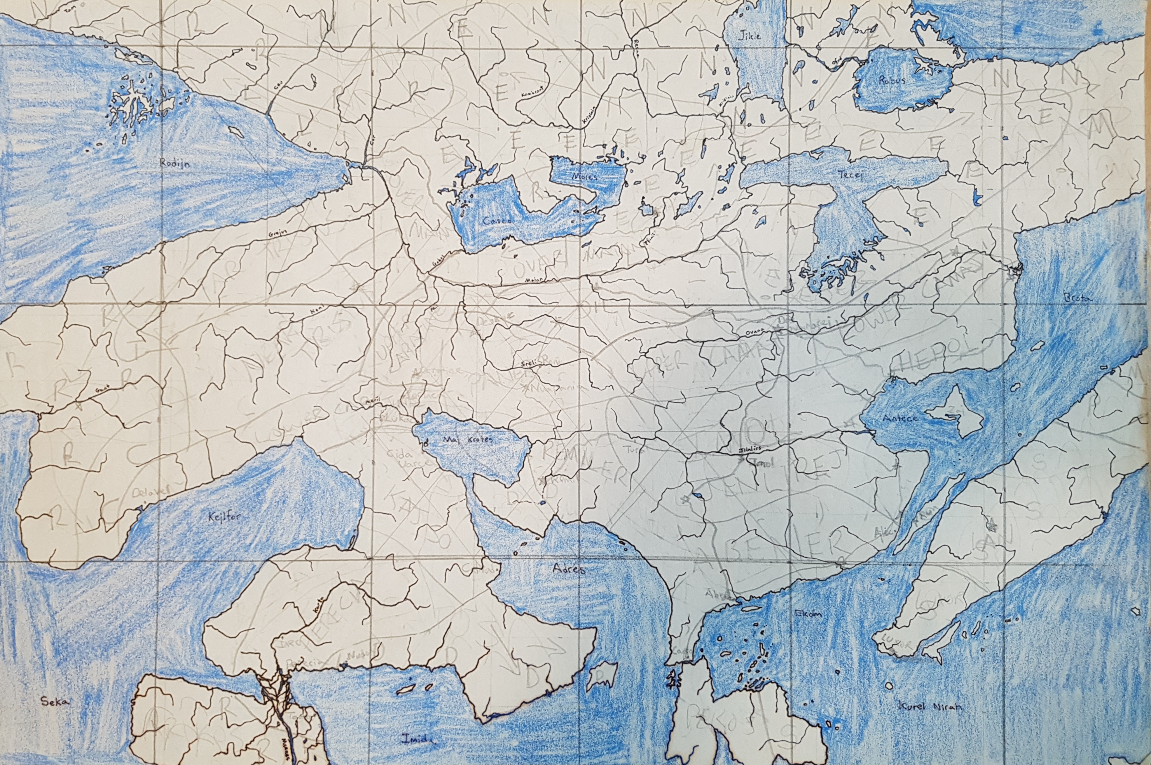
I decided since I had very little that’s actually new to report, I could fill this blog-space with some ancient mappings. I have been doing geofiction since grade school. Here are two maps drawn on paper from a long ago era.

This is the city of Nerro, drawn when I was aged 10.

picture

This is the continent of Preye, on a planet with a frequently-changing name (but colonized by those brutal Mahhalians). I drew it probably in high school, but I don’t quite remember.

picture

Music to map by: Cimafunk, “Ponte pa’ lo tuyo.”