HRATE

In response to several queries from other geoficticians about how to set up a map server (e.g. Arhet or Ogieff), I decided to consolidate some documentation about how I got Arhet to work. It is here:

http://wiki.geofictician.net/wiki/index.php/HRATE

It is very much a work-in-progress. As I think of information to add, or decide to add more detail, I’ll fill it out. At some point, I’ll be trying to do a “re-build” of the Arhet stack to a new server (for reasons related to the fact that I have other things running on its current server that have a higher need for reliability), and when I do that, it will give me a chance to review and better understand the process.

Music to write documentation by: Erik Satie, “Gnossienne No. 1, 2, 3.”

Mission Statement

The point is clear: the purpose of the Organization is to be organized.

Several committees will have been created to pursue this goal, with necessary but not sufficient technocratic support staff.

The Committee and Directorate of Teleological Debate (for All Intents and Purposes)

This committee and associated support staff attempts to address the question, Why does the Organization exist? Is the ongoing organization of such organizations as this Organization strictly necessary? Importantly, it advocates that a main purpose of the Organization is to discuss (but avoid resolving) such questions.

The Committee and Directorate of (Mis-)Direction

This committee and associated support staff attempts to address the question, Who controls the Organization? How is this control (if it exists) implicated in processes of organizational creation and perpetuation? Is it possible for the various committees and directorates of the Organization to accomplish their goals without direction? Is direction perhaps inimical to the Organization?

The Committee and Directorate of Cryptic Origins

This committee and associated support staff attempts to address the question, To what extent are the demiurges behind our perceived reality (this knowable Ardisphere beneath our feet) actually more real? More troubling, what are these demiurges’ motives? Are they a unified front, or a disparate group operating at cross-purposes? What are their origins? And to what extent do they wilfully misrepresent their true motives and origins?

The Committee and Directorate of Semiotic Action

This committee and associated support staff attempts to address the question, How can the Organization best emit a maximum proportion of signs to actual meaning? How best can the resources available (e.g. diaries, newscasters, hermetic hypertexts and encyclopedic simulacra) be leveraged to increase the full coverage of the Known Universe with (and by) content-free organizational representations?

Music to organize to: Mexican Institute of Sound, “Mi negra a bailal.”

Maps Marker Test

Trying to test the “maps marker plugin” for use with my Hellbridge MUD worldmap. I’m feeling skeptical that I can make use of it.

[UPDATE 20210530: This maps marker plugin has stopped working. They want money to “upgrade” to some paid version. Nuh-uh. Therefore… well, here’s an alternate way to put a marker, but I don’t know if it could work for my Hellbridge project or not.]

Music to test wordpress plugins to: Loreena McKennitt “Bonny Portmore”

Longtime Geofictioning

Arhet remains a work-in-progress. I’ve come up with two not necessarily incompatible tag-lines for the project:

  1. “Imaginary real estate doesn’t need to be a scarce resource.”
  2. “Sometimes you want to just toss verisimilitude out the window and map something crazy!”

I’ve been working on a kind of side-project, where I’m trying to get my MUD, called Hellbridge, to expose player location information to some kind of API or queryable dataset, such that I could then use something like a multimaps window in the wiki or wordpress to show player location on a map. This is a customization of the out-of-the-box CoffeeMUD platform I’m trying to use, and my Java programming skills are non-existent, which makes it difficult, but it would be a cool and unique feature if I could get it to work.

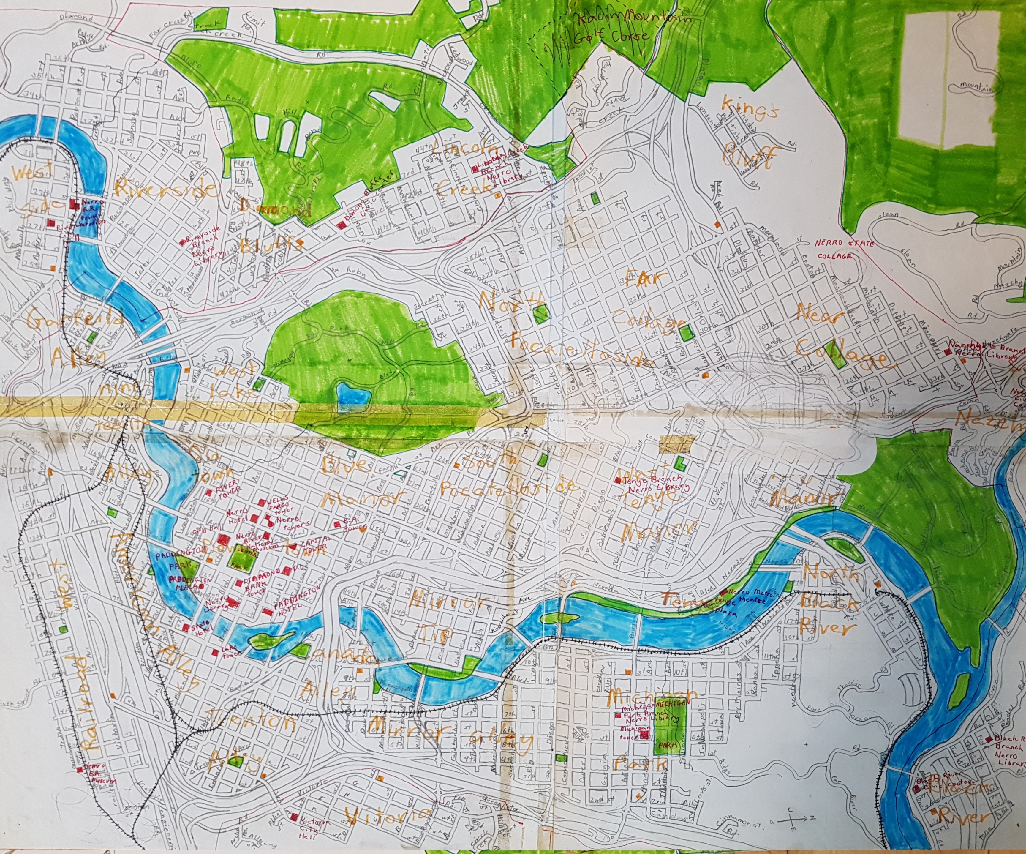
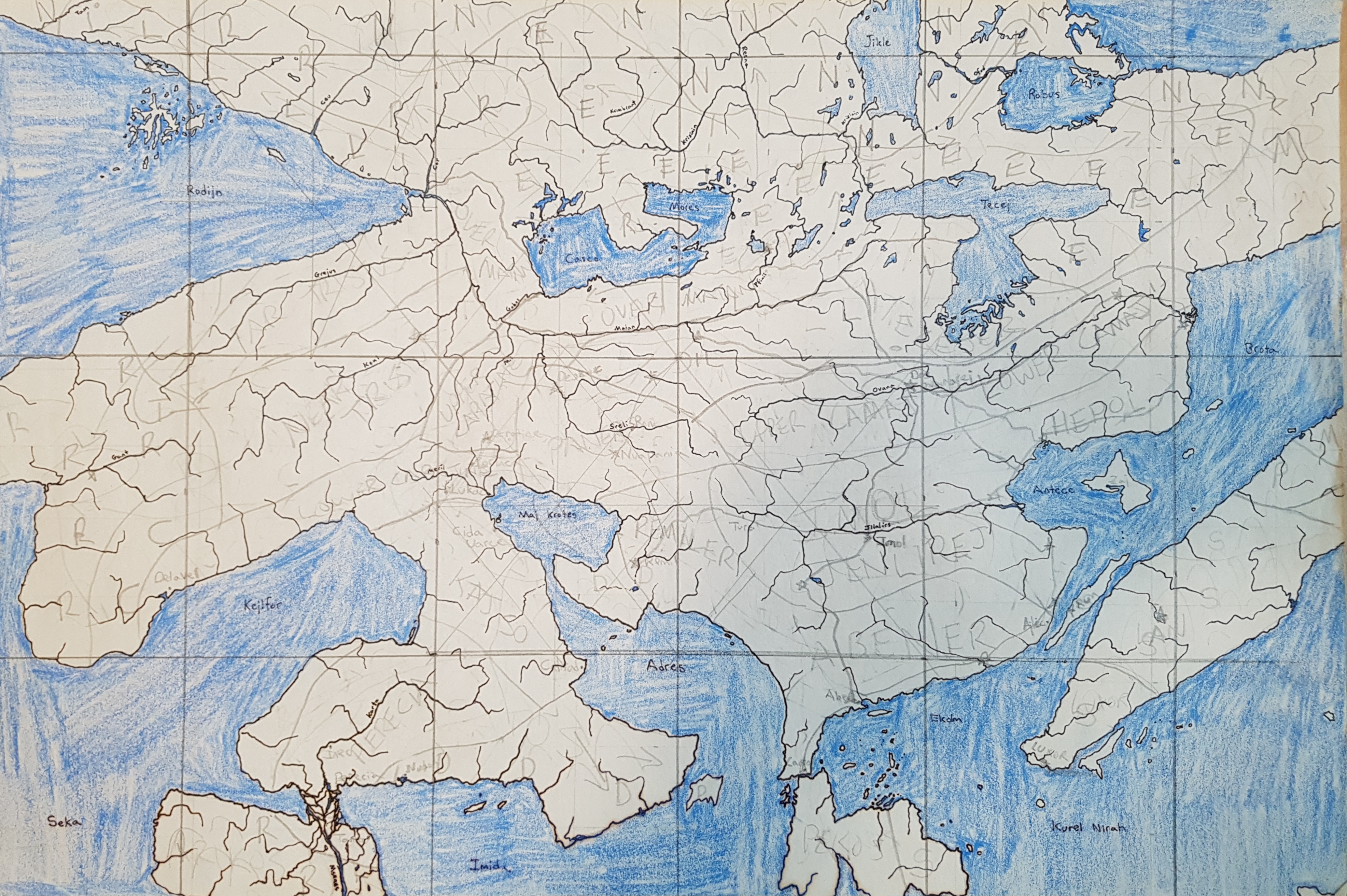
I decided since I had very little that’s actually new to report, I could fill this blog-space with some ancient mappings. I have been doing geofiction since grade school. Here are two maps drawn on paper from a long ago era.

This is the city of Nerro, drawn when I was aged 10.

picture

This is the continent of Preye, on a planet with a frequently-changing name (but colonized by those brutal Mahhalians). I drew it probably in high school, but I don’t quite remember.

picture

Music to map by: Cimafunk, “Ponte pa’ lo tuyo.”

Sitting in an 1880’s Ohunkagan brownstone, dreaming of an imaginary world named Arhet

I have utterly neglected this blog.

I offer no excuses. Just didn’t cross my mind. I had other things going on. I have other blogs and other, non-geofictional projects that occupy me.

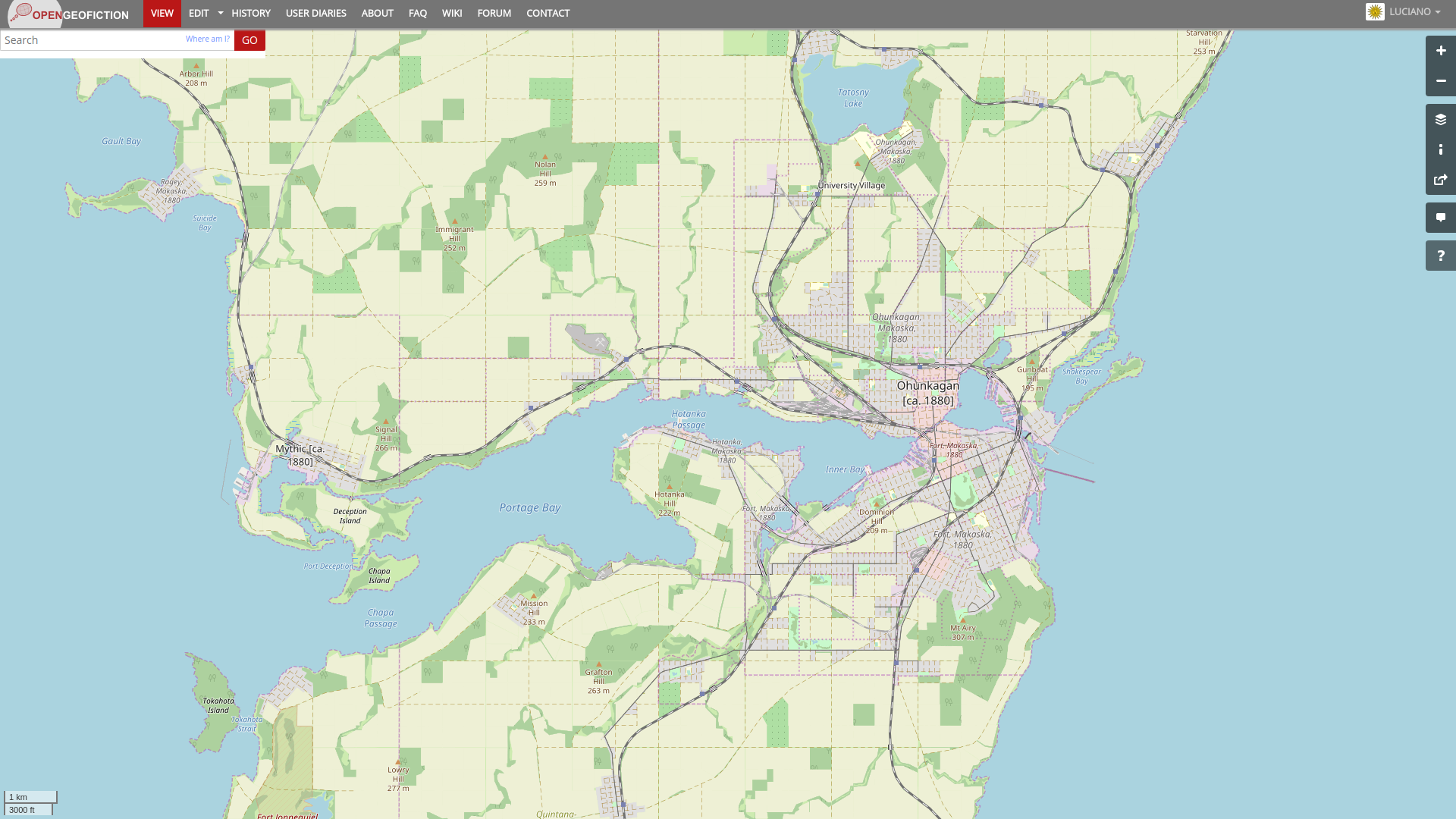
In fact, I have been quite busy with geofiction, too. Over the last 6 months since my last blog post here, I have been developing my “Ohunkagan 1880” snapshot, at OpenGeofiction. This is my city in my fictional state of Makaska, in the parallel-universe US called FSA. Here is a screenshot of the city, in its 1880 incarnation. I intend to then roll the historical window forward, mapping in changes and additions, over the coming decades, until it catches up to the present.

picture

[Technical note: screenshot taken at this URL (for future screenshots to match).]

But I have also been working on my own, long-neglected map server. I have named my planet: Arhet.

It’s just a name. But one thing that always annoyed me about OGF was that the planet not only lacks a name, but there has always been strong community resistance to finding a consensus name for it. Someone is always bound to object to any proposal, and thus, “OGF world” remains unnamed. For my planet, I decided to just put a name on it from the start, so no one would end up grappling with the dilemma later.

Arhet is tentatively open to interested mappers. I’ve written up my current thinking on how this will work, here:

http://wiki.geofictician.net/wiki/index.php/Arhet

Music to make worlds by: The Youngsters, “Smile (Sasha Remix)”.


A year later

This blog is one year old today. I founded it on Saint Patrick’s Day, last year. That’s why there’s that little shamrock on the first entry.

I really haven’t posted as much as I intended, here, over the last year.

My life underwent such huge changes, mostly unexpected. I ended my 11 year residency in South Korea and moved back to Southeast Alaska. I’m still in a bit of transition in terms of career, and meanwhile living off my savings.

I took a break from the OGF admin team last summer, then worked really hard the last few months. I have become very frustrated with trying to do admin on that site. Indeed, I have become deeply disillusioned – mostly with myself, and my inability to maintain a charitable and good-willed mindset in dealing with a never-ending onslaught of faceless trolls and juvenile idiots. I’d rather cope with a classroom of unruly 7th graders.

In a few days, I’ll be traveling to my mother’s in Queensland for a few weeks: a long crossing of the Pacific. I’ll be constrained by obligations to relatives, so I’m taking a leave-of-absence from OGF and geofiction. I have resigned the admin position permanently. It will be hard to let go, but I feel I must do so for my own peace of mind.

Music to map by: Olga Bell, “Пермский Край.”

Git topo

I finally got tired of dealing with Windows 10 drama, and decided to rebuild my preferred Ubuntu Linux desktop, as I’d been using in Korea before moving away last July.

I’ve made good progress on that, and have JOSM up and working again, and all that. But I became aware, as I was migrating my data and files, that I have a lot of files I would rather not lose, especially related to my geofiction. I need some systematic means of keeping stuff backed up.

I handled the issue of backup and redundancy for my creative writing years ago, when I started storing all my drafts and notes in google docs. It’s convenient, too, because I can get to my writing no matter where I am.

But I have no such system for all my .osm files for the geofiction. Especially important are the .osm files I use for drawing the topo layer, since those are never uploaded anywhere except temporarily at the time of an update.

I suppose I could just copy the files. But I decided I needed to store them in some kind of version-controlled space. About two years ago, I’d had them in a git repository but it was just copied out to an extra harddrive. I used git for some other stuff I used to do, so it wasn’t that hard to figure out.

I decided this time to try something different – I made a repository on github and decided to put my topo .osm files there. If I get in the habit of regularly updating the git repository, I’ll always have those topo files, no matter what happens to my computer or where I am. Further, if ever I go in the direction of wanting to collaborate on drawing topo files, this will make it really easy (assuming the other person is up to dealing with checking things out of a git repository). [UPDATE: this was a short-lived effort. Subsequently the files are just files, again, but they live on one of my HRATE servers]

If ever there will be a truly collaborative geofiction “planet” with a master topo layer, this might be a way to maintain that information, since practically speaking it can’t and shouldn’t be uploaded to the map server. Just an experiment, I guess, and meanwhile I’ll have a reliable backup of my work.

Music to map by: 선미, “가시나.

Subway Philosophy

Someday, I will return to work on my great metropolis, Villa Constitución. And when that day comes, I shall take on the huge project of refactoring the complex subway system I designed.

When designing subways, one should have a philosophy of subways in mind. Here is an essay every subway designer must read: “Stoppism: Retrospects and Prospects“.*

*Footnote for the dense: the linked article is satire – a gorgeous, brilliant joke.

Music to design subways by: Silvio Rodríguez, “Santiago de Chile.”

admin blues

<rant>

It’s all pretty depressing.

I try to be a competent and fair and innovative admin on OpenGeofiction.

Half the users hate me – I know this for an actual fact, because I see what gets said on the OGF unofficial discord channel.

And now I’m feuding with the “boss” too. I can’t win – I’m stuck in the middle. I’m not paid for this. So why am I doing it?

Perhaps I should go back to trying to build my own geofiction server and forget this. Although I derive a lot of motivation and inspiration from the OGF community, trying to be an engaged and active member feels like more suffering than benefit, some days. I would do better to not try to change or “fix” things, but that’s not in my character.

I don’t know if the creator of OGF and I really share much in terms of vision. To initial appearances, he seems committed to the “open-” part of the name, and to open source projects and concepts. Yet upon further examination, he seems utterly uninterested in trying to go anywhere toward working out a more scalable and/or sustainable governance model for the site. And for any sizable internet community (or real community for that matter), governance is actually important. So in the end, it’s just a personal fiefdom. I can feel sympathetic to that… – that’s probably how I would set my own site up. But then, what’s the “open” about? Is it just because he used the OSM stack? It feels like false advertising: “Bait and switch.”

This is just a rant.

</rant>

Music to admin by: Robbie Fulks, “America Is A Hard Religion.”

5 Years Mapping and Naming

I failed to commemorate my 5th anniversary on OGF. I mapped my first node on January 31, 2014. Maybe there were a few nodes mapped before this, but they have been deleted, and they were on that same date. Puerto Desolado was my first OGF town.

Only today, I felt a moment of nostalgia.

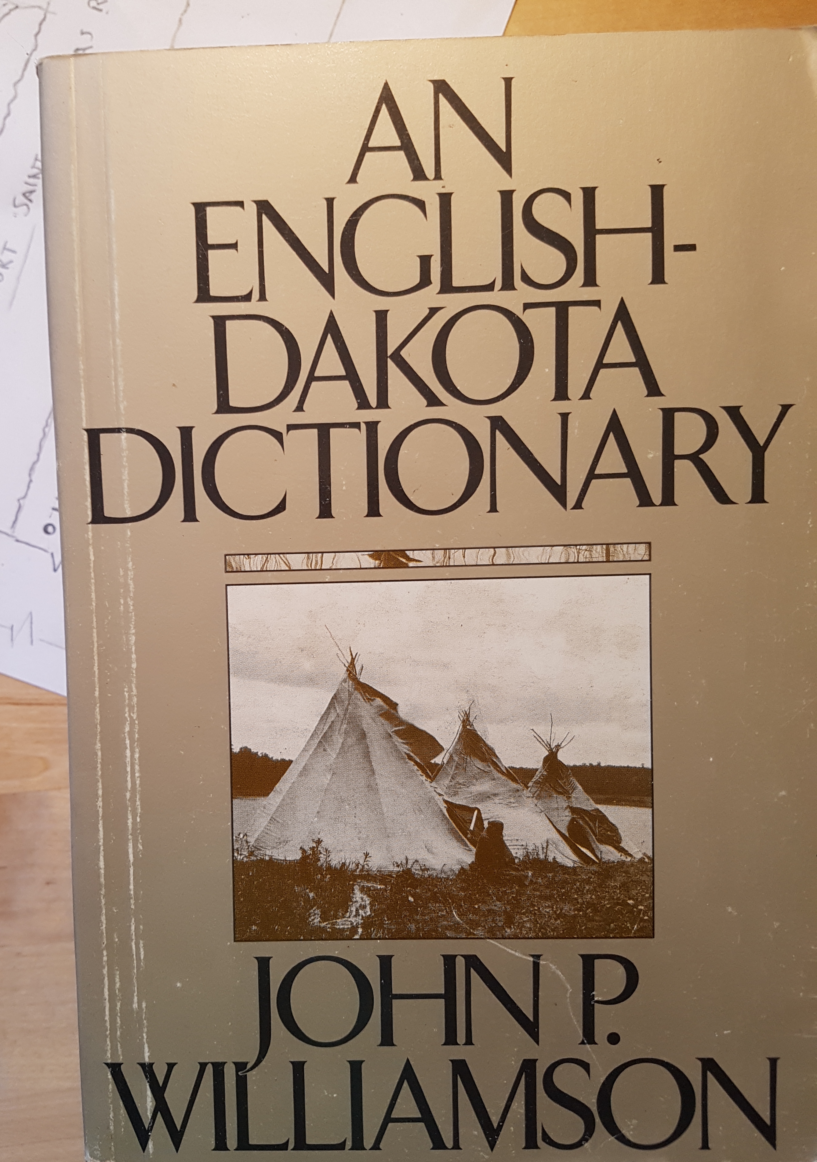
I keep working, slowly, on Makaska. One thing that’s important to me: the “native” names in the state are the pseudo-fictional Rakhoda language. This is just an alternate name for the Dakota language, as spoken by the native peoples of southern Minnesota in the pre-European era. So all the native names of the state are actual Dakota words. Hence when mapping, I keep this hand book on my desk:

picture

Music to name things by: Sioux Honor Song