Kshang Native Lands

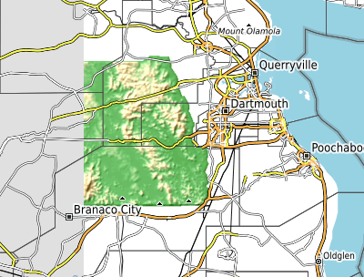
This weeks low-effort brag-post is a new topo area for the Kshang Native Lands area in the country of Rhododactylia. Rhododactylia is not my “owned” territory, rather, it’s a free-to-edit public space on the map server. Posting mapping in these public areas is a bit fraught – various individuals come along and vandalize, alter, and otherwise mess with one’s creative work. But Rhododactylia seems to draw a higher-quality mapper than many of the public areas on the OGF server, such that I feel some hope this work will be respected and added to.

I originally created the Kshang Lands in around 2016 I think. But I recently decided to take my passion for detailed contour mapping and apply it to a free-to-edit area, and this seemed like a great place to try.

The Kshang are one of the native people in Rhododactylia, overwritten by colonists. Just like the real world, right? Anyway, they have a fairly prosperous economy in their little hilly center of the country.

Here is a screenshot showing the roughed in topo area.

picture

Here is a link to the area on the slippy map: https://opengeofiction.net/#map=15/-44.7401/146.6816&layers=B

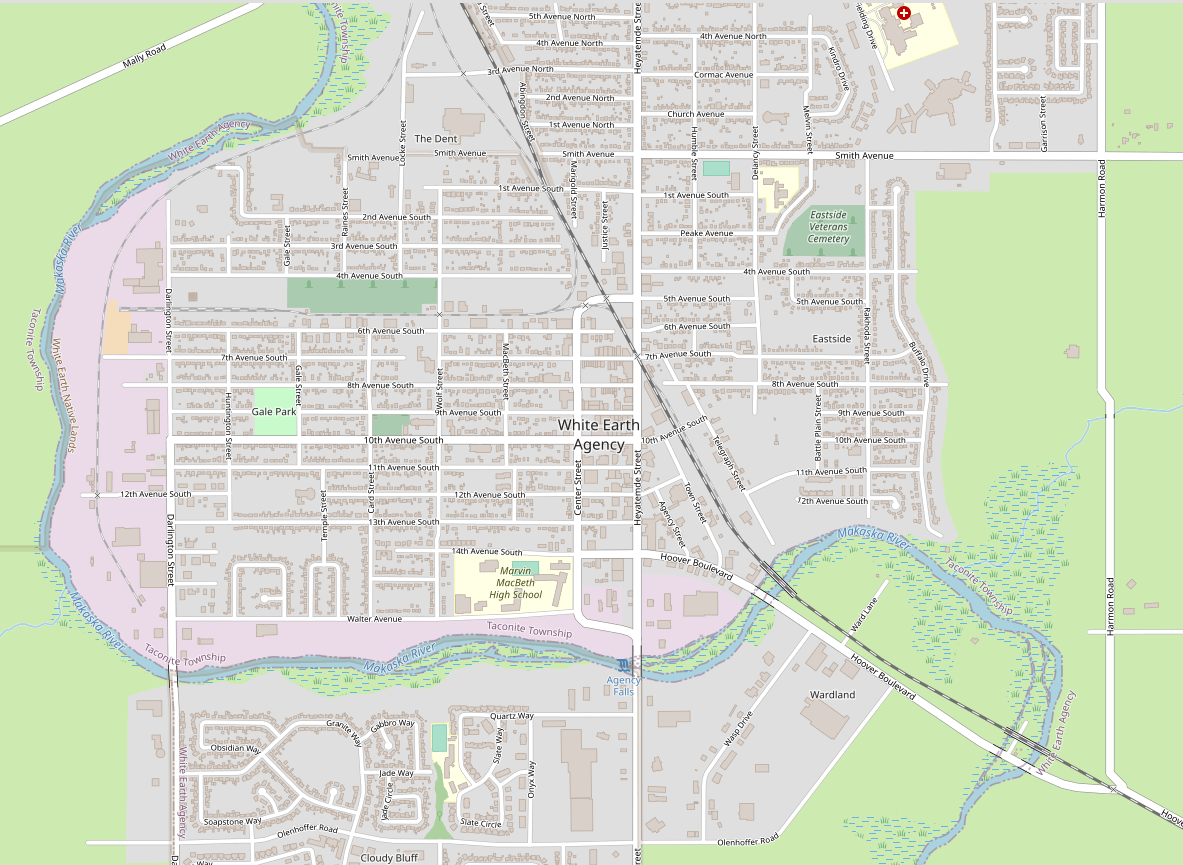
White Earth Agency

My low-effort brag post for the week is something I uploaded just this very moment – some detail (buildings, streets, a few schools/churches/businesses) for the town of White Earth Agency, a rural county seat in southern Makaska, but also the “capital” of the Federated Tribes, a fictional kind of “league of native reservations” that helps empower the native peoples of Makaska and neighboring Ooayatais Province, coordinating social services, advocacy and similar.

Screenshot of the map window on the OpenGeofiction site, showing an area mapped of a town called White Earth Agency with lots of detail

Here is a link to the slippy map on OpenGeofiction: https://opengeofiction.net/#map=15/-43.3101/145.3347&layers=B

Goodgrove

For this week’s low-effort brag-post of my geofiction, I’m taking a detour off the OpenGeofiction site and going to my other map-server, the planet called Arhet. I built this map-server before rebuilding the OpenGeofiction site – it a sense, it ended up as a kind of audition for being considered qualified to take over OGF. Anyway, there are far fewer users on Arhet, it’s a much smaller server, and it’s quite a bit more chaotic – there is no effort to create a coherent “world” the way that we do on OpenGeofiction. It’s just little map-snippets the various users are working on. Unlike OGF, there are no constraints on realism. That’s why I put this bit of mapping on Arhet.

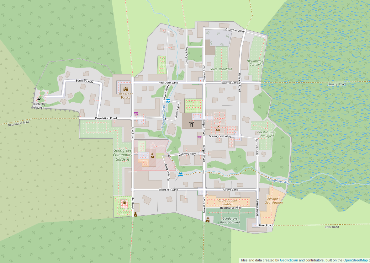
Goodgrove is the “start town” for a MUD (“multi-user-dungeon” – a type of text-based old-school computer game) I was desigining for a while, with a working title of Hellbridge. That work is definitely dormant – I haven’t worked on it in years. The setting is a kind of semi-steampunk, semi-swords-and-sorcery setting. But I had the novel idea that I could create a detailed map of the world, much higher quality than that typically associated with MUD’s, and that I could even go in the direction of having some kind of “player locator” icon on some customized presentation of the map. So you would be moving around the game-world and meanwhile you could be logged into a website hosting a slippy map of the world, and you could see an icon that placed your location in that world.

I still think it’s a compelling and clever idea, and within the realm of what I could conceivably create, but I simply didn’t have the energy or gumption to push forward with it. But the starter town of Goodgrove was mapped down to every detail, and every single node on the in-game map has a corresponding node on this OSM-style map. It’s not meant to be strictly realistic – it’s a game map for a fantasy setting, not meant to represent any verisimilitudinous place.

Screenshot of the map window on the Arhet website, showing an area mapped of a village called Goodgrove with lots of detail, including stores and paths between buildings.

Here is link to the zoomable map: https://arhet.rent-a-planet.com/#map=16/41.9412/-66.8451&layers=W

Country Club Alameda, Ohunkagan

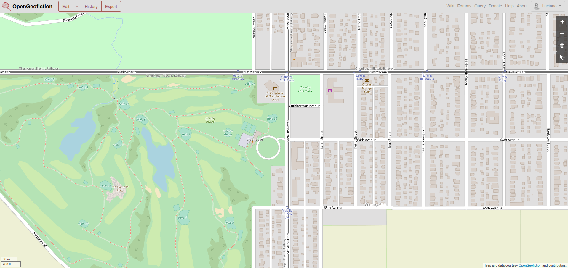
My low-effort brag-post for this week is a neighborhood called “Country Club Alameda, in the imaginary city of Ohunkagan. The mapping is currently in a time-warp, not yet having reached 1920, but there’s an intersection of two streetcar routes at 63rd Avenue and Melville Street, and a golf course southwest of that.

Screenshot of the map window on the OpenGeofiction site, showing an area mapped of a neighborhood called Country Club Alameda with lots of detail, including a golf course.

This neighborhood is found on the opengeofiction map here: https://opengeofiction.net/#map=17/-42.49772/146.04194&layers=B

MundoMar

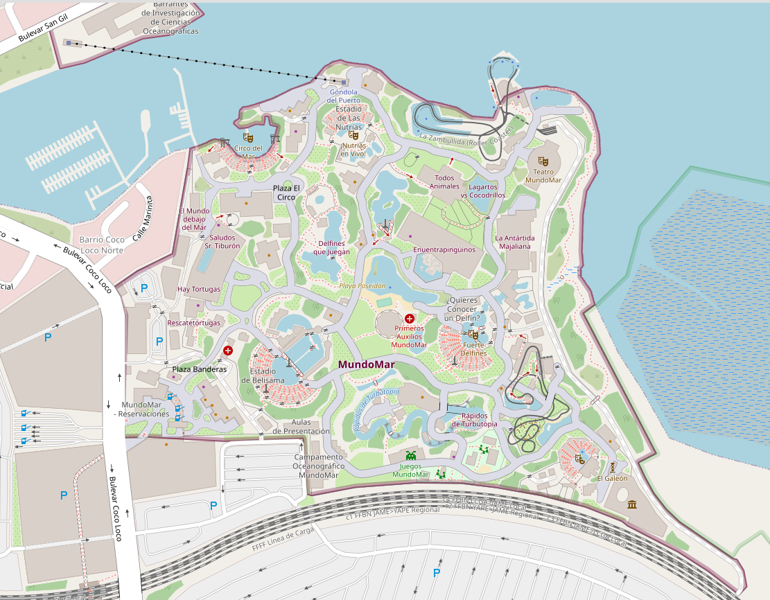
My low-effort geofiction bragpost for the week is a theme park called MundoMar in the country of Ardesfera.

I’m not  as good at what’s called detailed or micro-mapping, but I thought this was a good effort. It’s a maritime-themed theme park, maybe somewhat modeled on Sea World – though I haven’t visited Sea World in about 50 years.

The surroundings to the theme park are not as well mapped, and the farther afield you go, the more embarrassed I am by the work. Much of this mapping is from my first year on the opengeofiction site (2014), when I was still learning how to use the tools and figuring out what was possible in the realm of “slippy map geofiction”.

Here is a screenshot of the spot:

Screenshot of the map window on the OpenGeofiction site, showing an area mapped of a theme park called MundoMar with lots of detail.

The area shown is here on the map server: https://opengeofiction.net/#map=17/-24.47490/124.33675&layers=B

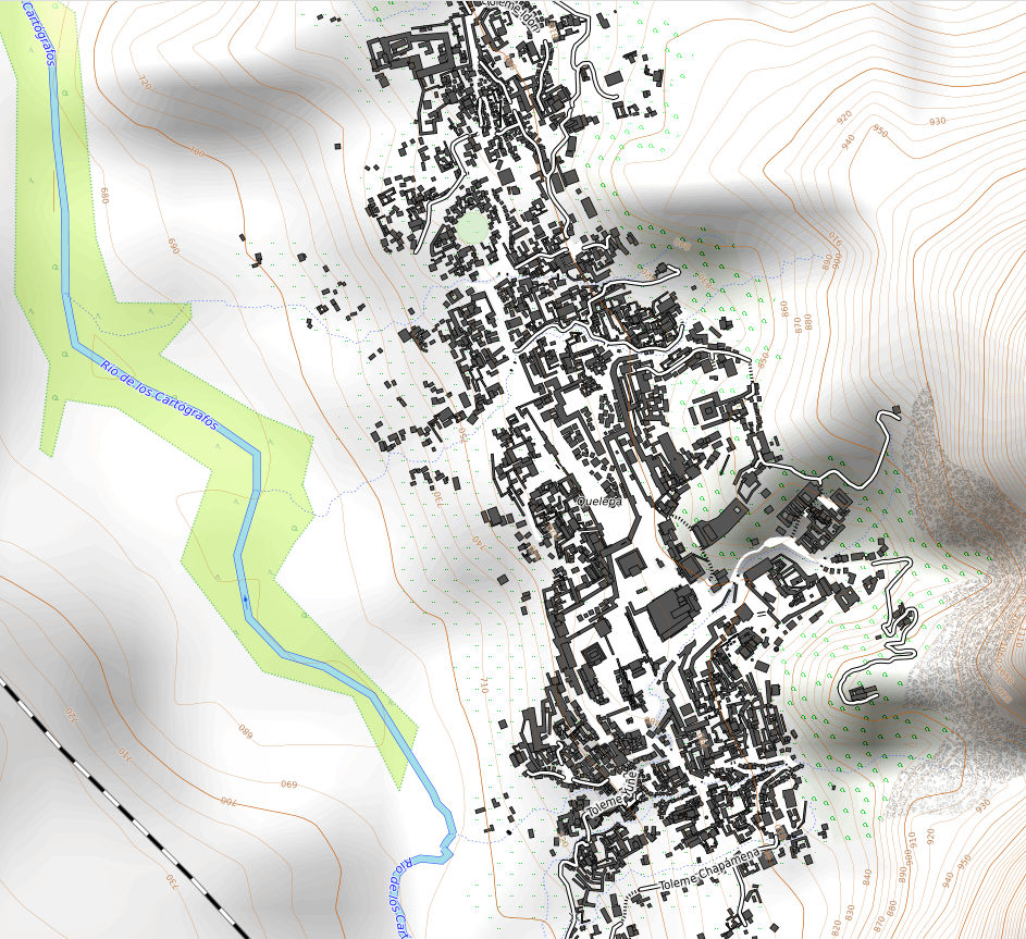
Quelepa

For this week’s low-effort bragpost, I’m sharing my pre-modern ceremonial capital, Quelepa. The plan that I had, long ago, was to create this circa 1400’s city, in the style of maybe a Mayan or Aztec city, and then overlay a modern city over it, using a historical mapping process. But I never got around to it, so the city is still there, in a kind of anachronistic reservation within the otherwise modern country of Ardesfera. That explains the bit of railroad seen in the lower left of the screenshot.

I was especially pleased with the city because it conformed to the already-drawn contours (topo) for the region. I also did some minor work on a conlang for the culture involved, which I used to name all the various temples included.

A screenshot of the zoomable map on the OpenGeofiction.net website, showing a pre-modern ceremonial city with detailed buildings and walls, and a background showing the contour lines of the area's physical topography.

Here is a link to the zoomable map: https://opengeofiction.net/#map=16/-21.7931/121.6496&layers=V

Springfield

I felt that my faux-midwestern state, Makaska, would need a “Springfield” – doesn’t every real US state have a “Springfield”?

For this week’s low-effort brag-post of my mapping on OpenGeofiction, I’ll post this view of Springfield. Unlike most other parts of Makaska where I’ve mapped, this is not being done chronologically. It’s meant to represent the modern state of the map. I don’t feel it’s complete, but a lot is done – at least 65% done I’d say.

picture

Here is a link to the map: https://opengeofiction.net/#map=14/-41.5031/148.4594&layers=B

Faux-midwestern, rural Makaska

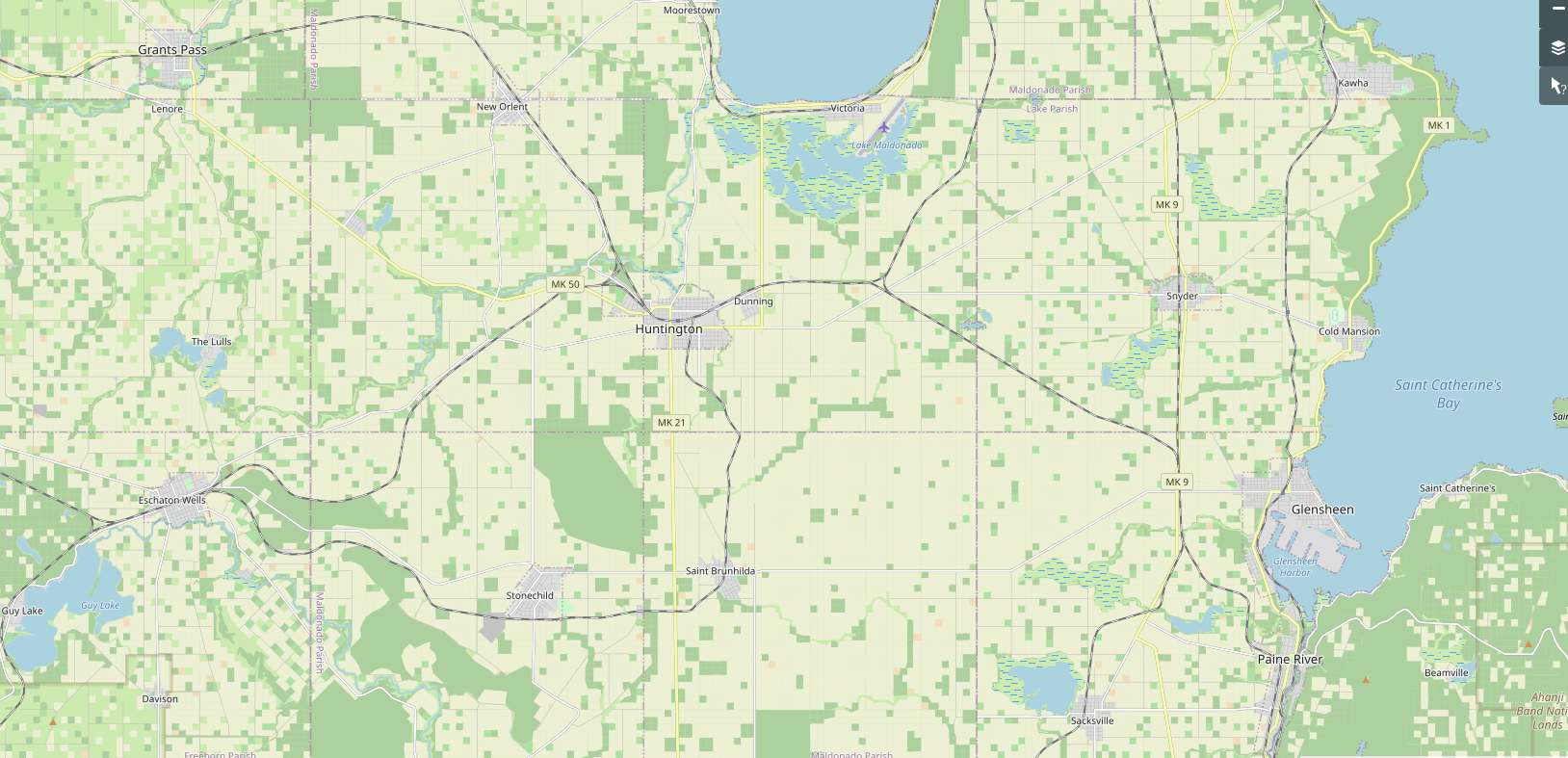
This is my low-effort map-brag of the week. This is quite recent work – mostly done in the last year or so. It’s in the central-south of my imaginary faux-US-midwestern state of Makaska. Like most of Makaska, this region is being drawn “historically” – which is to say, I’m trying to add features and such in a rough chronological order. As such, this still incomplete mapping is stuck somewhere in the very early 1900’s right now, and still needs quite a bit of work before I’d even feel comfortable to advance the calendar.
A screen shot of the website opengeofiction.net . This is a
Here is a link to the location on the map: https://opengeofiction.net/#map=12/-43.0508/145.6341&layers=B

Still my proudest accomplishment

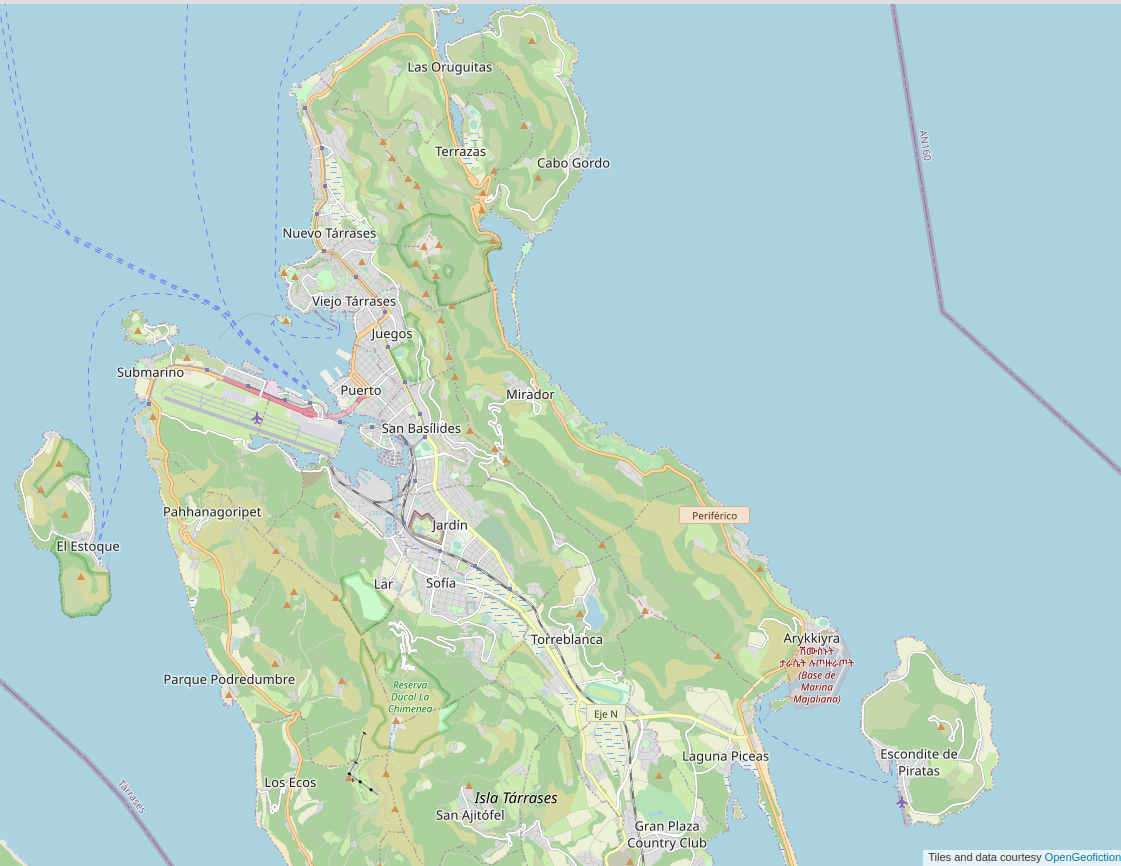
For this week’s low-effort post reviewing my geofiction work on opengeofiction, I’ll present what I still consider my “masterpiece” – it’s the best bit of geofiction I’ve created for any OSM-style platform (i.e. opengeofiction.net or arhet). I did this work mostly in 2015-2016.

That’s my island city-state called Tárrases. It includes a well-wrought contour layer.

picture

Here’s the link: https://opengeofiction.net/#map=12/-58.3003/83.9568&layers=B


Provincia de Amor

As I said last week – I’m going to try to do a low-effort post of past or current geofiction work once a week.

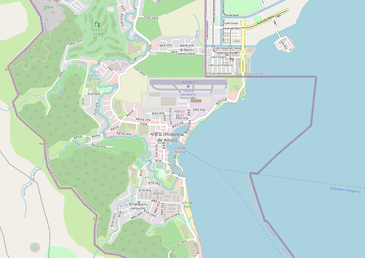
For this week, I’ve been feeling nostalgic for my years living in South Korea. So I decided to post a geofiction I did while living there, in 2015 or so. It’s not the greatest – there are aspects I can even say I feel a bit embarrassed by, but at the time it was the best I’d done so far, and I was quite happy with it.

Screenshot of a map of an imaginary place called Sarang-do, hosted on the OpenGeofiction map server

Here’s the link to the map: https://opengeofiction.net/#map=15/-20.7997/124.2137&layers=B

It’s a little bit tongue-in-cheek, linguistically. My Korean language skill isn’t that good, so the naming is probably amusing or cringey for those who are better with Korean. The whole idea is that this is a quite small, touristically-oriented, Korean-speaking exclave of my imaginary country called Ardesfera (Ardisphere). Bear, in mind, therefore, that anything outside of Sarang-do’s borders is not my work – and there’s been quite a bit of turnover by the neighbors, too, so I don’t actually know who’s currently mapping in the surroundings nor what their concept is – it’s clearly incomplete.