Sunset Township

I’ve neglected this weekly posting for half a year – mostly feeling I didn’t have anything new or interesting to share. A lot of my mapping has been ‘support and cleanup’ work on my own topo layer stuff, where small incremental changes and a messy overall appearance mean it’s rarely worth sharing. Let’s not call it ‘weekly’ anymore.

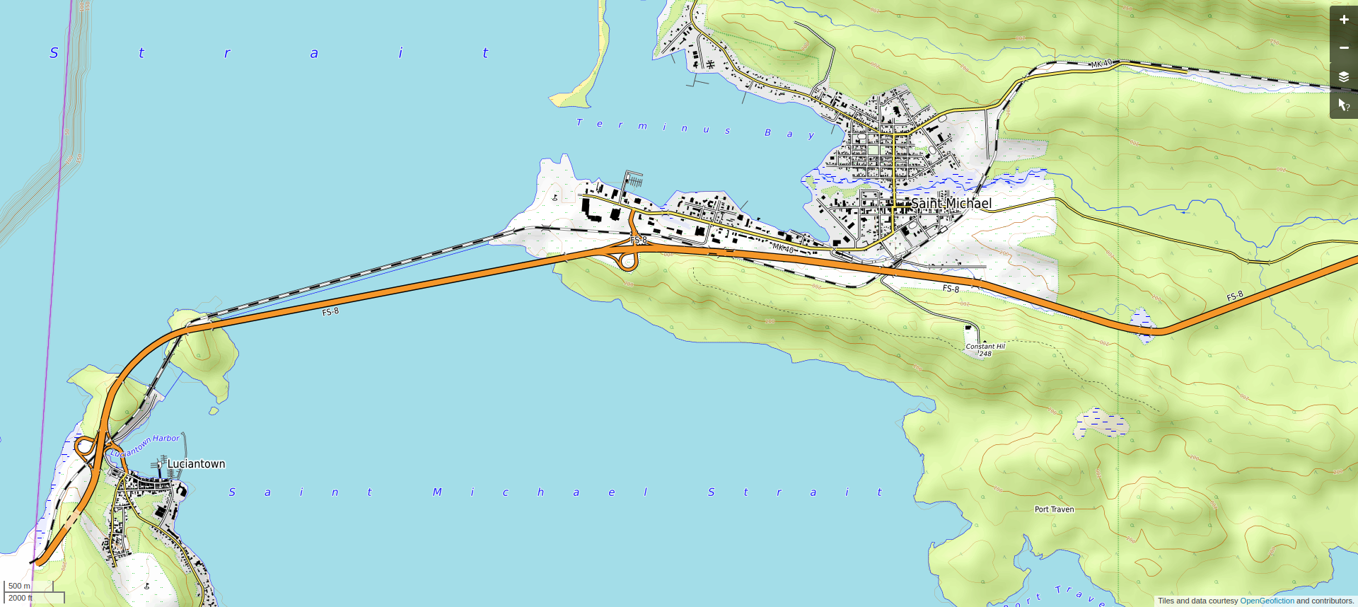
Anyway, my low-effort brag-post, this time, is to show the western end of the Wachacha Peninsula, the area known as Sunset Township, with the towns of Luciantown and Saint Michael. These are on the southwest edge of the state of Makaska. The economy in the area, such as there is, is mostly tourism-related. I’m pleased with how the towns fit to the hilly terrain of the area – these are not huge mountains, but the topography is meant to resemble the western part of Michigan’s “Upper Peninsula.”

Here is the area in regular view.Screenshot of the map window on the OpenGeofiction site, a rural area with a small town at the end of a peninsula and another town on an island west of the town, in standard map view
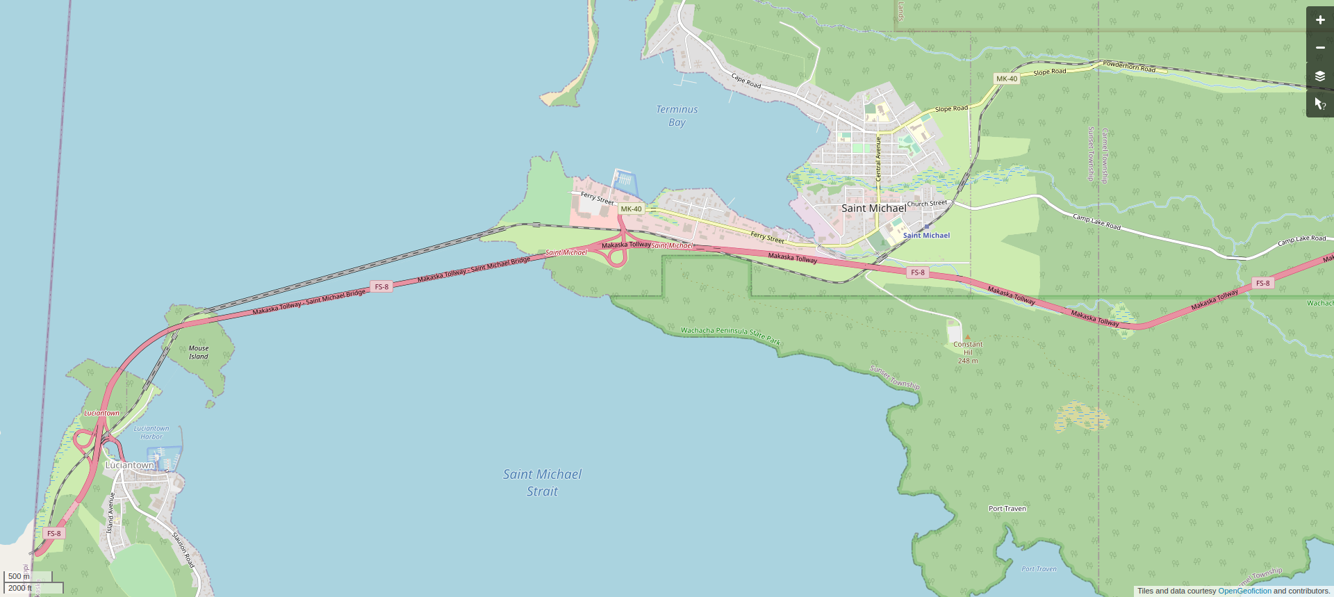
Here is the area in topo view.Screenshot of the map window on the OpenGeofiction site, a rural area with a small town at the end of a peninsula and another town on an island west of the town, in 'topo' view

This area is found on the opengeofiction map here: https://opengeofiction.net/#map=14/-42.7526/143.9197&layers=V

Paine River

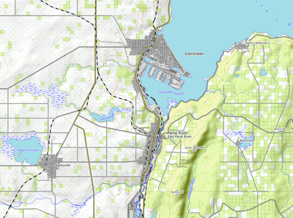
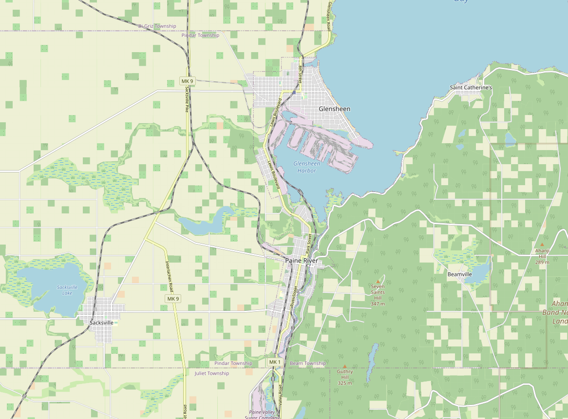
My low-effort brag-post for this week is showing the “twin towns” of Glensheen and Paine River, in the southeast part of the state of Makaska. Like all of region surrounding metropolitan Ohunkagan, these towns are currently stuck in a time-warp, sometime around 1920, as I try to develop the whole region chronologically. In the 1920’s, Glensheen, with its active port and industrial base, far exceeded Paine River in size. However, my expectation is that by the contemporary era, the towns will have equalized in size, as the industrial base in Glensheen declines and the exurban clout of Paine River grows. Paine River will be the modern southernmost terminus of a commuter rail line all up and down the “Silicon Shore” south of central Ohunkagan. The farm and forestlands are still a bit schematic, and need detailing, but the basics are definitely in place. I’m particularly pleased with how you can see the interaction of topography and landuse in the topo view.

Here is the area in regular view.

Screenshot of the map window on the OpenGeofiction site, a rural area with several medium-sized towns at the bay of a large lake and and river valley, with lots of detail

Here is the area in topo view.

Screenshot of the map window on the OpenGeofiction site switched to the

This area is found on the opengeofiction map here: https://opengeofiction.net/#map=13/-43.1165/145.8464&layers=B

Midesapa

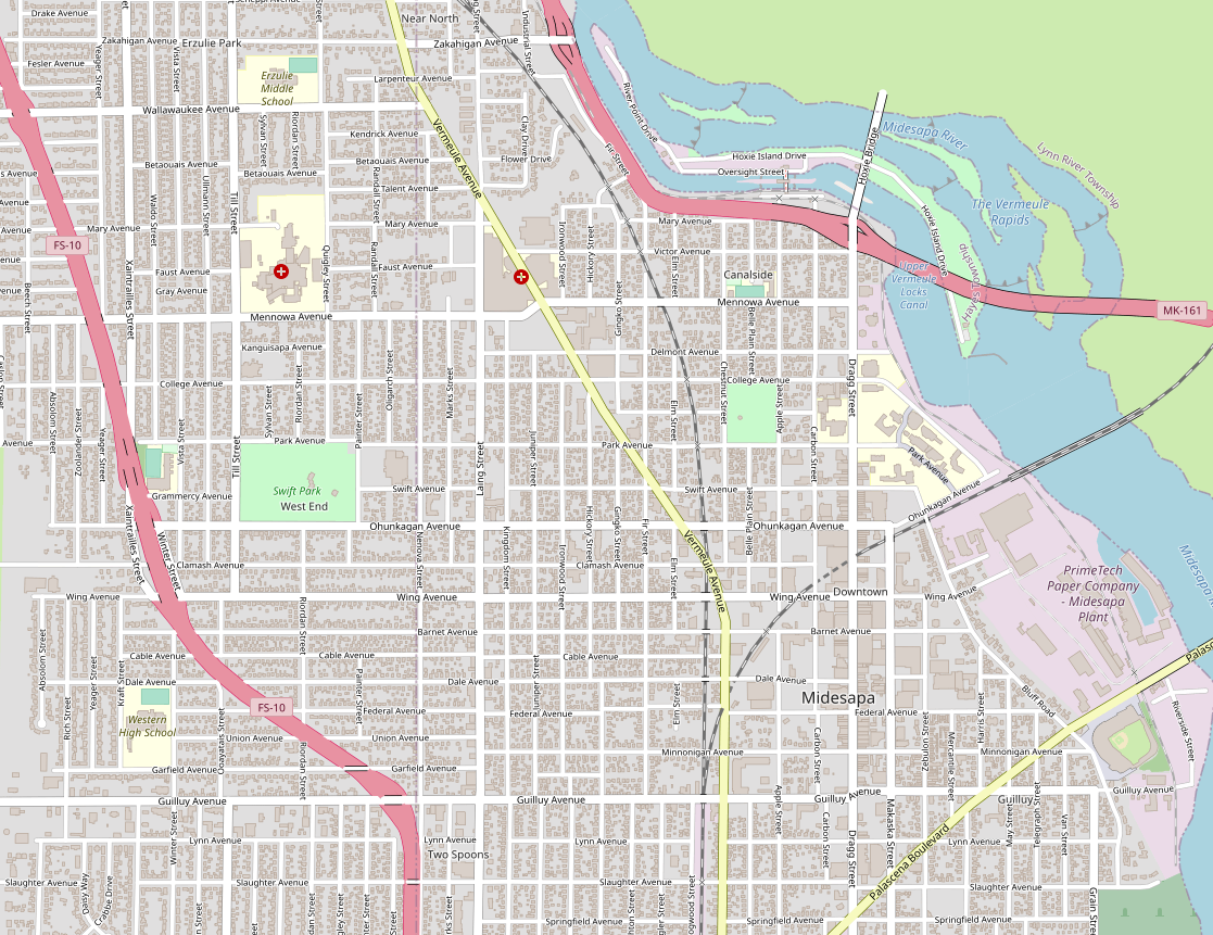
My low-effort brag-post for this week is the central part of a city called Midesapa, in the northern part of the state of Makaska. It’s a rust-belt city on a river that connects two large lakes, so in that sense it occupies an economic position similar to Detroit, but it’s a much smaller city, with maybe 200k in the metropolitan area. There is still much detailing to be added but the basics are there.

Screenshot of the map window on the OpenGeofiction site, showing an urban area mapped along a river running from south to north, with lots of detail, including some freeways and a paper mill and locks and rapids along the river

This neighborhood is found on the opengeofiction map here: https://opengeofiction.net/#map=15/-41.3257/147.3513&layers=B

Yojándara

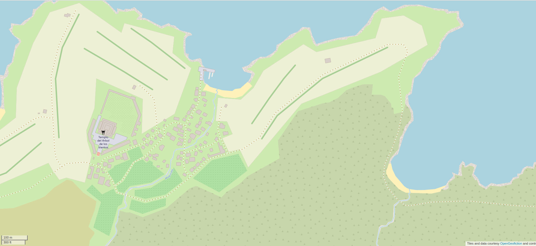
My low-effort brag-post for this week is a pre-colonial coastal village called Yojándara, in the country called Ardesfera. It is near to the city of Arbaronga, on an island just off the coast. In the “present day” (modern era) this is a tourist-oriented area near the big city, reachable by ferry, with a quaint village and restored ruins. The mapping of the area currently on the map, seen here, is a historical snapshot at around 1450, before the Ulethan colonists from Ingerland and Castellan showed up.

Screenshot of the map window on the OpenGeofiction site, showing an area mapped of an area on a seashore, with lots of detail, including a village and a temple

This neighborhood is found on the opengeofiction map here: https://opengeofiction.net/#map=17/-24.42120/123.90046&layers=B

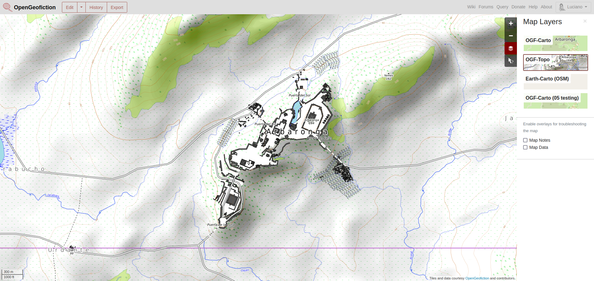
Arbaronga

My low-effort brag-post for this week is a pre-colonial hilltop fortress city called Arbaronga, in the country called Ardesfera. In the “present day” (modern era) this is not far from the center of the vast metropolis of Villa Constitución, which is the capital and largest city of Ardesfera. The fortress city remains as a grouping of restored ruins, a historical tourist attraction. The mapping of the city currently on the map, seen here, is a snapshot at around 1450, before the Ulethan colonists from Ingerland and Castellan showed up. The fortress area at the hilltop is mostly complete, but I haven’t mapped much of the surrounding area, meant to be covered in intensive agriculture. In the modern era, this is all city.

Screenshot of the map window on the OpenGeofiction site, showing an area mapped in the

This neighborhood is found on the opengeofiction map here: https://opengeofiction.net/#map=15/-24.3398/123.7518&layers=V

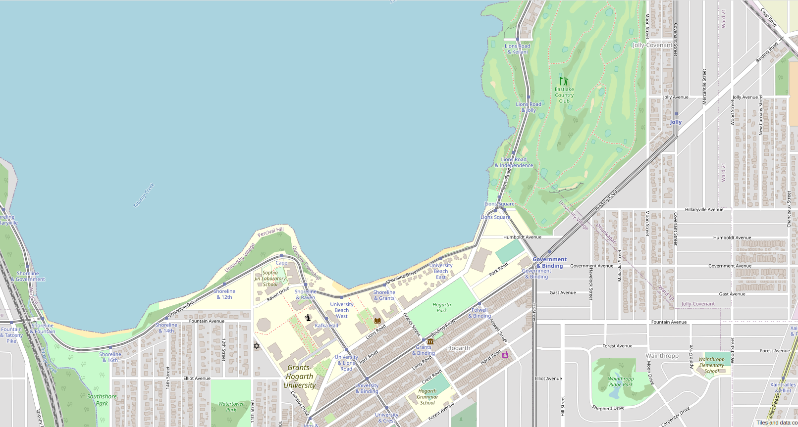
Grants-Hogarth University and surrounds

My low-effort brag-post for this week is the neighborhood around Grants-Hogarth University, in the imaginary city of Ohunkagan (including an enclave jurisdiction called University Village). The mapping is currently in a time-warp, not yet having reached 1920, and it’s not really complete, but I’m running out of things to post. There are some easter-egg type jokes in the map, including “Chomsky Hall” near the intersection of Government Avenue and Binding Road, thus near the Government & Binding station on the elevated railway.

Screenshot of the map window on the OpenGeofiction site, showing an area mapped of an area around a lakeshore with lots of detail, including a university campus and a golf course

This neighborhood is found on the opengeofiction map here: https://opengeofiction.net/#map=16/-42.3298/146.0850&layers=B

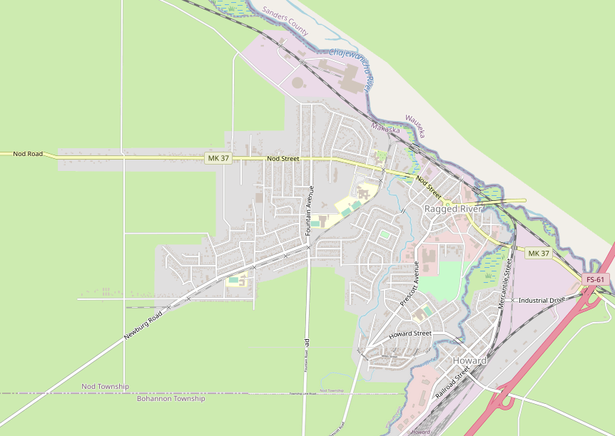
Ragged River

My low-effort bragpost for this week is something I created last month. This is a small town (maybe 8000 residents) in the northeast of my imaginary state of Makaska, named Ragged River, with a matching, smaller community across the parish boundary, called Howard. I haven’t completed it, especially the rural surroundings, but it’s complete enough to show I guess.

Here’s a screenshot of the location.

Screenshot of the map window on the OpenGeofiction website, showing the towns of Ragged River and Howard, on opposite sides of a river; the state boundary is along the larger Chajewanicha River running from southeast to northwest

The link to the slippy map is here: https://opengeofiction.net/#map=15/-15.1153/146.7819&layers=B

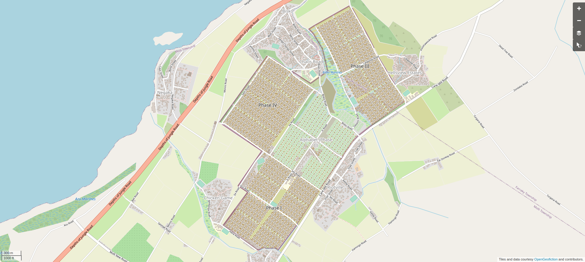
Irhoborin

My low-effort bragpost for this week was created around 6 years ago. It is a bit more dystopian than usual. For the most part, my geofictions are neither dystopian nor utopian – rather, they just represent an alternate reality which is much like our own, full of both good and bad. This was an effort to create something a bit darker. It’s a refugee camp, in a poorly-defined (quite incomplete) war-torn country with serious social problems and poverty and a negligent government. Perhaps somewhat inspired by Somalia or 1970’s southeast Asia.

The Irhoborin refugee camp is vast: it has a population of tens of thousands, all in these tents in grids with additional tens of thousands in improvised shacks between and among and surrounding the gridded tent areas. I actually wrote up a fairly detailed “lore” for this place, at one time, and have an archived copy of it here.

Here’s a screenshot of the location.

Screenshot of the map window on the OpenGeofiction website, showing the patchworked grids of the Irhoborin refugee camp and some surrounding, chaotically-laid-out communities

The link to the slippy map is here: https://opengeofiction.net/#map=15/-15.1153/146.7819&layers=B

The Planet Rahet

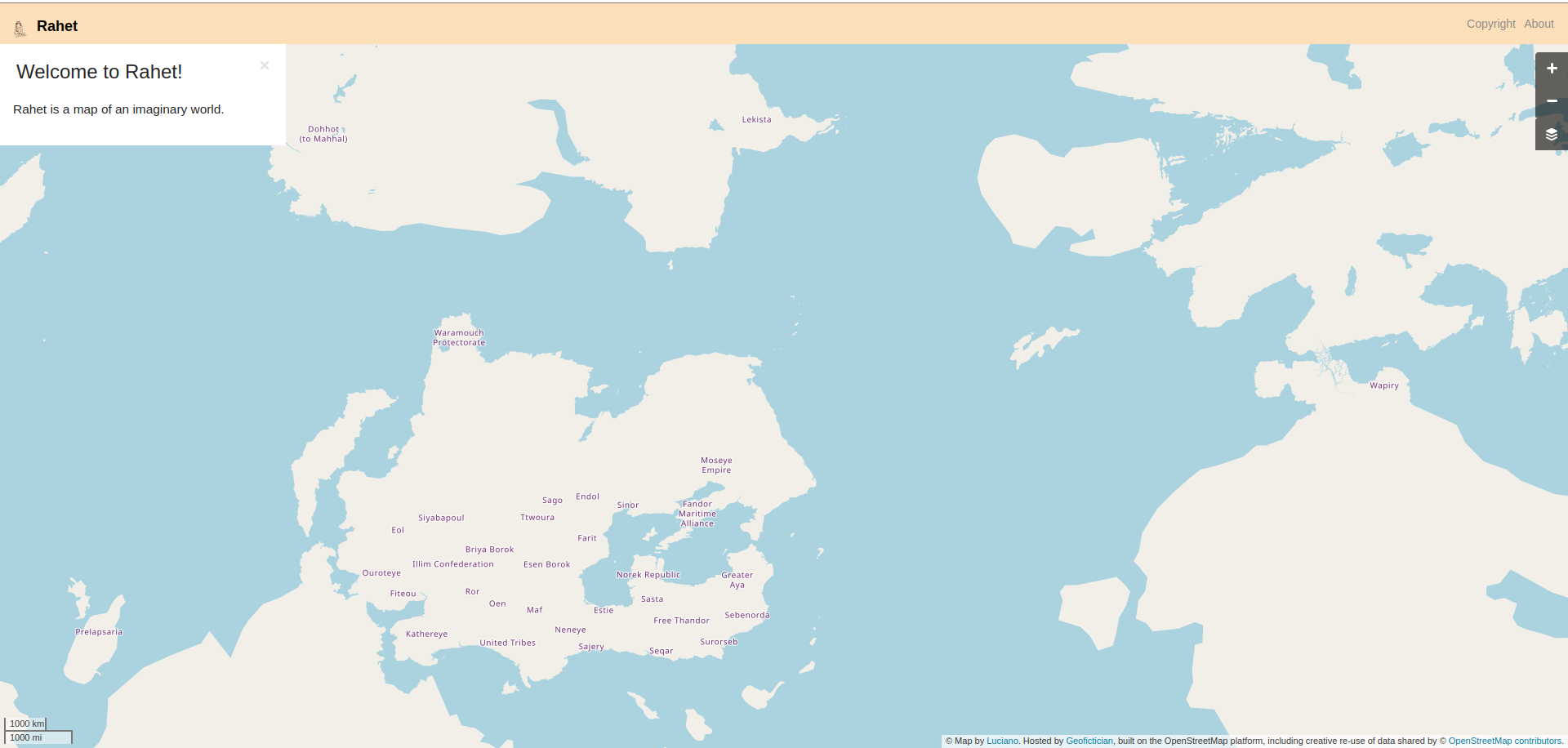
My low-effort bragpost for this week is not the usual suspects, but rather a whole ‘nother planet: Rahet. I think I’ve written before about Rahet, but it’s been a few years, maybe.

Rahet is a “slippy map” planet, on the OSM platform, just like Ogieff (opengeofiction.net) or Arhet (arhet.rent-a-planet.com). For a long time, Rahet was languishing with a moribund render and no api server. But I recently got both up and running again such that it’s just as easy to edit and update the Rahet map as it is for those other planets. Unlike those other planets, though, Rahet is just mine – I haven’t opened it up to other mappers and I don’t intend to. It’s meant to be the setting for a sci-fi novel that I occasionally work on, started some 30 years ago. The map is pretty spare – filling a whole planet is of course utterly impossible.

Here’s a screenshot of the planet.

Screenshot of the map window on the Rahet website, showing the whole planet, zoomed out, with some continents and a few country names

The link to the slippy map is here: https://rahet.rent-a-planet.com/#map=3/-12.04/-21.97&layers=R

Stroadland

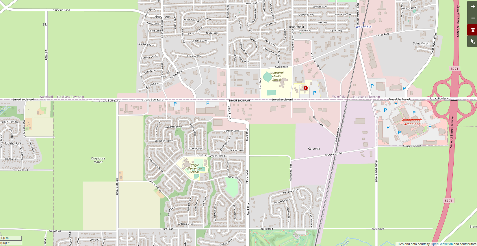
My low-effort bragpost for this week is an area of Makaska I have called Stroadland. It’s a bit of a joke, of course. I posit a pioneer in the area with the name Stroad, who is thus memorialized in the name. But of course “stroad” is a currently popular term for major streets in North American, car-oriented suburban development. Not really a street, not really a road: a stroad.

I still have a lot of detailing I want to add. I’ve only named a few stores or amenities, for example. I have a goal to make something that could easily be mistaken for OSM at zoom=15. I don’t think I’m there yet, but I’m making progress.

Here is a screenshot showing the area.

Screenshot of the map window on the OpenGeofiction site, showing an area mapped of a US-style, suburban neighborhood, with lots of detail

Here is a link to the area on the OGF slippy map: https://opengeofiction.net/#map=15/-41.2515/145.8573&layers=B